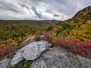
Descends gradually from the Attraction area to a small loop at open rocks, providing views of the Swinging Bridge, MacRae and Attic Window peaks, and Beacon Heights and Grandmother Mountain to the southwest. Rambling through northern hardwood and...
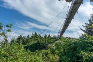
Climbs from the hiker parking area through a series of switchbacks through primarily spruce-fir woods, underneath the swinging bridge, and to the upper parking area and buildings. The understory is filled with rosebay rhododendron which bloom in...
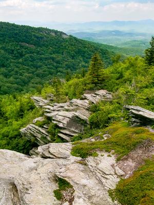
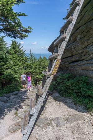
Although about 80% of the trail surface is in decent shape, it is steep, and some sections are quite eroded and rocky. At least one part is nearly a hand-over-hand climb. Passes by boulders and "crags" - rocky outcroppings that give the trail its...
Ascends 2000 feet from the Blue Ridge Parkway to Calloway Peak - 5964' in elevation. The upper half is rough, but has great views, including one of the Linn Cove Viaduct on the Blue Ridge Parkway. A few in-place ladders and cables help hikers up the...
Follows the length of Grandfather Mountain's summit ridge from the Attraction area near the Swinging Bridge to the summit of Calloway Peak. Travels through a spruce-fir forest, up and around rock walls and pinnacles, and through open meadows. There...
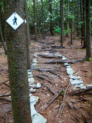
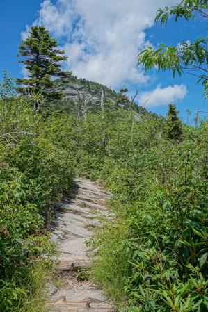
From the hiker parking below the summit, climbs through a series of switchbacks in a spruce-fir forest (with a healthy helping of blueberry and rhododendron shrubs in the understory). Rocky and rooty in places, with a couple of wood structures to...
Follows an old logging road. Easy but rocky; ends at Storyteller's Rock and a spectacular view of the Boone Bowl valley and up to Calloway Peak. Stream crossings, rhododendron tunnels, a spring channeled through a sluice, a stand of big-tooth aspens,...
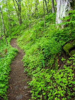
Probably the best way to "summit" Grandfather Mountain is via this fantastic trail, and I believe it's one of the finest trails in the state. The trail first winds through lush mid-altitude cove hardwood forests, with a few stream crossings and...
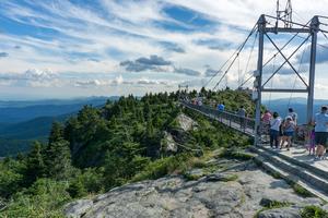
A short path which leads up the steps from the upper parking area, through an area of short spruce and fir trees, across the Mile High Swinging Bridge, and then over to the rocky viewpoints on Linville Peak. An easy walk, but there are some steps and...
0.1mi, Climbs Gently, Few Obstacles
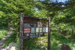
Nearby Trails
The following trails cross into this trailhead area, but are primarily accessed from another trailhead:
This excellent trail, completed in 1993, follows the contours of Grandfather Mountain above the Blue Ridge Parkway. It travels through interesting and diverse geology and forest environments, including northern hardwood forests and spruce-fir...