Buckhorn Gap Trail

At A Glance


4.6 mi one-way
Difficulty Rating: 4.6 ![]()
Steepness: Climbs Moderately ![]()
Tread Condition: Some Obstacles ![]()
Blaze Color: Orange
Trail Number: 103
Description
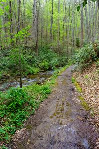
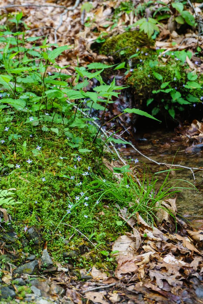
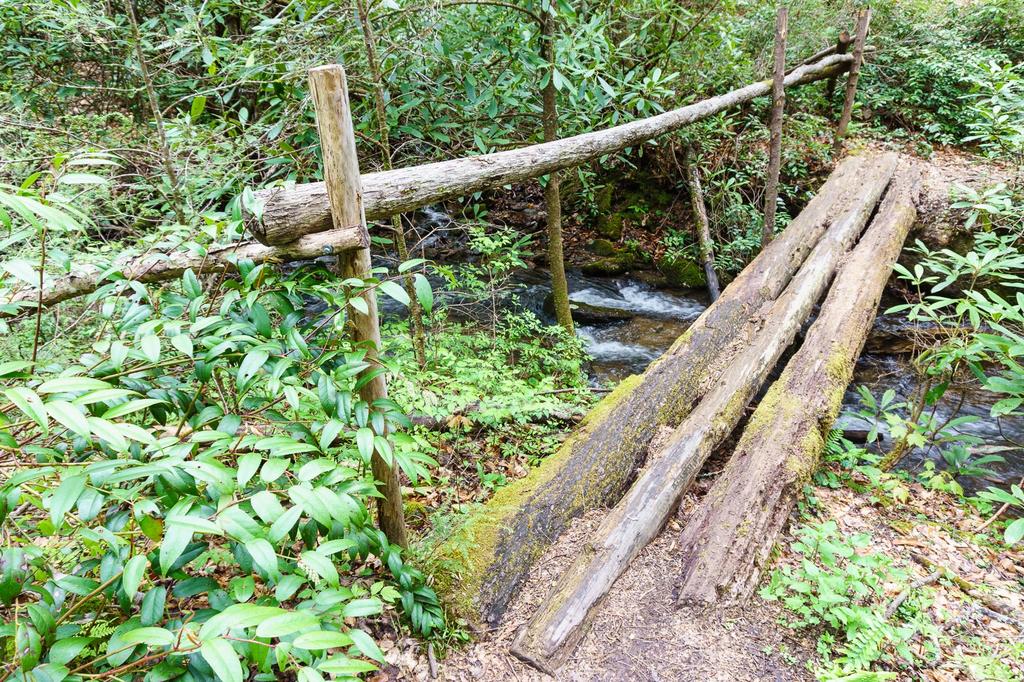
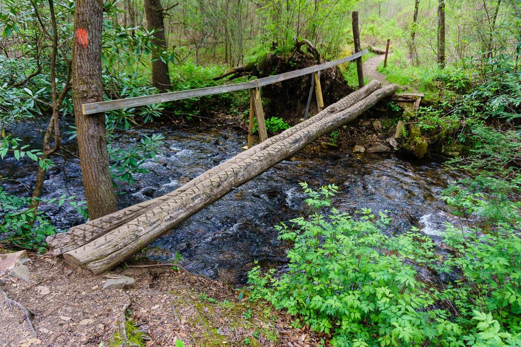
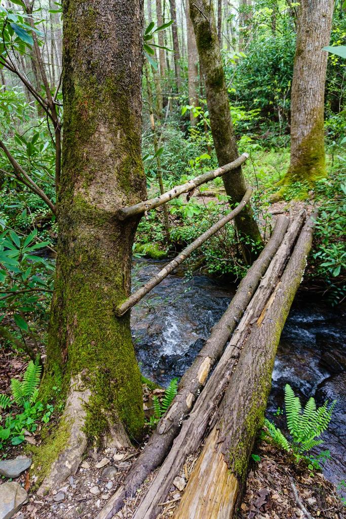
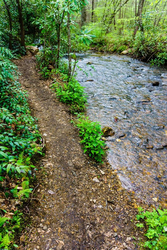
This fairly long trail has several creek crossings on its south end. These are completed via either log bridges or rock-hops and wades. The stream runs through a beautiful cove hardwood forest. There were formerly dense hemlock groves with some huge trees growing in them; these have mostly all died now due to infestation from the Hemlock Woolly Adelgid.
This trail intersects with a short spur to Twin Falls, which is a highly recommended side-trip. It also joins with the Avery Creek trail, making some shorter day-loop possibilities. Beyond Twin Falls, the trail mostly a climb sidehill up old logging roadbeds. Near the top, it intersects with and follows some gravel logging roads to reach Buckhorn Gap and the junction with the Black Mountain trail.
Beyond Buckhorn Gap, the trail descends an older logging road (becoming a trail again) into the South Mills River designated backcountry area to join the old South Mills River Road (now Trail). This connection opens up longer, multi-day backpacking options if combined with the Pink Beds, Black Mountain, Squirrel Gap, and/or Turkey Pen Gap trails.
The trail has recently undergone extensive re-engineering and repairs and is in better shape than ever; despite this, some rough, eroded, and muddy sections remain.
Intersecting Trails
This trail is located in the Davidson River area. For a list of all the trails in that area, see the Davidson River trails list page.
This trail also crosses into these trailhead areas:
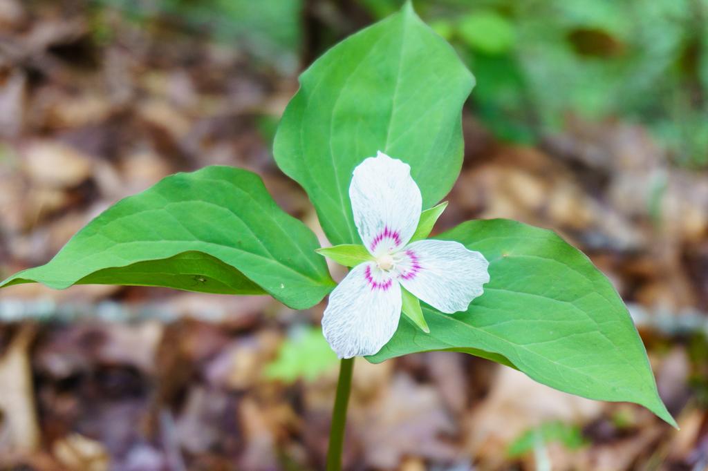
All Photos from the Trail


GPS Map
Map Information
Download GPS Data
Click on a route, trail, or point on the map and select the GPS Data tab to download its data.
Data Formats
KML (Google Earth)
KML is the main file type used by Google Earth. If you have Google Earth installed, clicking the KML link should open the trail or point directly in Google Earth for viewing. This is the native file format used by Google Earth, but many other map applications can use and understand KML as well, so if you're not sure which one to download, KML is a good bet.
GPX
The GPX format stands for GPS Exchange - a free, open, XML format for exchanging GPS and map data. GPX is compatible with Google Earth, many other mapping programs, and most GPS devices (such as Garmin). Load the file directly into your GPS to help find your way on your next trip!
GeoJSON
GeoJSON is a newer, lightweight data exchange format which can be used to quickly share map data and may have a smaller size than KML or GPX. Many professional mapping and GIS applications support the GeoJSON format.
About the Map
Copyright
Base Layers
Base layers provided by OpenStreetMap, the US Geological Survey, the US Forest Service, and NC OneMap. Base layer images are subject to the respective copyright policies of their owners. Base layers may not be available at all times due to system maintenance or outages.
WNCOutdoors Base Layer
The WNCOutdoors Base layer is provided by WNCOutdoors.info. It is licensed by Creative Commons Attribution 3.0.
Trail and Marker Overlays
Trail layers and downloadable data are all original works created by WNCOutdoors with guidance from a variety of sources, including ensembles of our own GPS tracks, user contributed GPS tracks, official maps and GIS data from government agencies, and field observations. WNCOutdoors data is made freely available under the Open Database License - you are free to copy and use it for any purpose under the terms of that license (summary).
Tips
- Hover over a trail to see it highlighted. Helps to see start and end points for an individual trail.
- Scroll and zoom the map before printing, and that view will persist into the printed image.
- Click a trail for more details and to download it individually.
Trail Segments
Trails are often made up of several connecting paths which may have different characteristics, allowed uses, and seasons. This trail is divided into multiple segments as follows:
Buckhorn Gap - Buckhorn Gap to S. Mills River Tr.
- Allowed Uses: Hiking, Mountain Biking, Horseback Riding
- Length: 1.78 mi
Buckhorn Gap - Clawhammer Road to Buckhorn Gap
- Allowed Uses: Hiking
- Length: 0.31 mi
Buckhorn Gap - Twin Falls to Clawhammer Rd.
- Allowed Uses: Hiking, Mountain Biking
- Length: 1.22 mi
Buckhorn Gap - Twin Falls Lower to Upper
- Allowed Uses: Hiking, Mountain Biking
- Length: 0.11 mi
Buckhorn Gap - Avery Creek to Twin Falls Lower
- Allowed Uses: Hiking, Mountain Biking
- Length: 0.7 mi
Buckhorn Gap - Avery Creek Crossing
- Allowed Uses: Hiking, Mountain Biking
- Length: 68 ft
Buckhorn Gap - FS 475 to Avery Creek
- Allowed Uses: Hiking, Mountain Biking
- Length: 0.92 mi
Total Calculated Length: 5.05 mi
This value is derived from our underlying map data, and it may not match officially published information.
Feedback
Ratings
Average Rating: (rated 0 times)
Rate It Now:

No comments yet.