Panthertown Valley Trail

At A Glance


3.3 mi one-way
Difficulty Rating: 3.3 ![]()
Steepness: Climbs Gently ![]()
Tread Condition: Few Obstacles ![]()
Trail Number: 474
Hikes That Use This Trail: Panthertown Valley Tour
Description
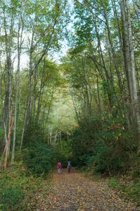
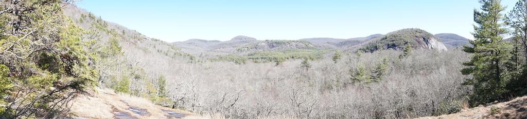
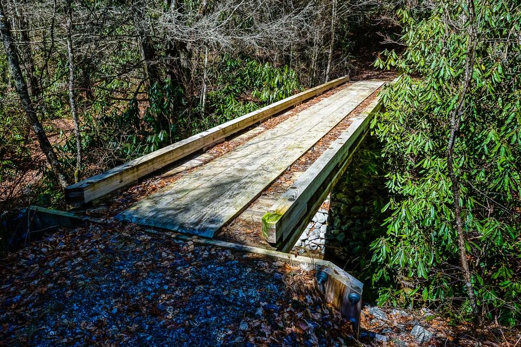
This is the main trail through the valley which stretches from the Cold Mountain entrance to the Salt Rock entrance. Portions of this trail are open to horses and/or bikes. It passes near many of the main attractions within the valley, so many loop hikes will utilize it. The surface is generally gravel or dirt/doubletrack, with some lengths near Panthertown Creek that are sandy. Being an old road (with the exception of the stretch leading North from the Cold Mountain parking area), grades are generally gentle to moderate.
Intersecting Trails
This trail is located in the Panthertown Valley area. For a list of all the trails in that area, see the Panthertown Valley trails list page.
All Photos from the Trail


GPS Map
Map Information
Download GPS Data
Click on a route, trail, or point on the map and select the GPS Data tab to download its data.
Data Formats
KML (Google Earth)
KML is the main file type used by Google Earth. If you have Google Earth installed, clicking the KML link should open the trail or point directly in Google Earth for viewing. This is the native file format used by Google Earth, but many other map applications can use and understand KML as well, so if you're not sure which one to download, KML is a good bet.
GPX
The GPX format stands for GPS Exchange - a free, open, XML format for exchanging GPS and map data. GPX is compatible with Google Earth, many other mapping programs, and most GPS devices (such as Garmin). Load the file directly into your GPS to help find your way on your next trip!
GeoJSON
GeoJSON is a newer, lightweight data exchange format which can be used to quickly share map data and may have a smaller size than KML or GPX. Many professional mapping and GIS applications support the GeoJSON format.
About the Map
Copyright
Base Layers
Base layers provided by OpenStreetMap, the US Geological Survey, the US Forest Service, and NC OneMap. Base layer images are subject to the respective copyright policies of their owners. Base layers may not be available at all times due to system maintenance or outages.
WNCOutdoors Base Layer
The WNCOutdoors Base layer is provided by WNCOutdoors.info. It is licensed by Creative Commons Attribution 3.0.
Trail and Marker Overlays
Trail layers and downloadable data are all original works created by WNCOutdoors with guidance from a variety of sources, including ensembles of our own GPS tracks, user contributed GPS tracks, official maps and GIS data from government agencies, and field observations. WNCOutdoors data is made freely available under the Open Database License - you are free to copy and use it for any purpose under the terms of that license (summary).
Tips
- Hover over a trail to see it highlighted. Helps to see start and end points for an individual trail.
- Scroll and zoom the map before printing, and that view will persist into the printed image.
- Click a trail for more details and to download it individually.
Trail Segments
Trails are often made up of several connecting paths which may have different characteristics, allowed uses, and seasons. This trail is divided into multiple segments as follows:
Little Green Tr. to Devil's Elbow Tr.
- Allowed Uses: Hiking, Mountain Biking, Horseback Riding
- Length: 273 ft
Salt Rock Parking Area to Wilderness Falls Tr.
- Allowed Uses: Hiking, Mountain Biking, Horseback Riding
- Length: 0.26 mi
Wilderness Falls Tr. to Deep Gap Tr.
- Allowed Uses: Hiking, Mountain Biking, Horseback Riding
- Length: 0.35 mi
Deep Gap Tr. to Mac's Gap Tr.
- Allowed Uses: Hiking, Mountain Biking, Horseback Riding
- Length: 0.27 mi
Mack's Gap Tr. to Green Valley Tr.
- Allowed Uses: Hiking
- Length: 0.67 mi
Green Valley Tr. to Powerline Road
- Allowed Uses: Hiking
- Length: 0.28 mi
Powerline Road to Little Green Tr.
- Allowed Uses: Hiking, Mountain Biking, Horseback Riding
- Length: 0.41 mi
Devil's Elbow Tr. to Cold Mtn Gap.
- Allowed Uses: Hiking, Mountain Biking, Horseback Riding
- Length: 0.91 mi
Cold Mtn. Gap to Cold Mtn. Parking Area
- Allowed Uses: Hiking, Mountain Biking
- Length: 0.16 mi
Total Calculated Length: 3.36 mi
This value is derived from our underlying map data, and it may not match officially published information.
Feedback
Ratings
Average Rating: 2.8 (rated 4 times)
Rate It Now:

No comments yet.