Hiking in the Shelton Laurel & Camp Creek Bald Area of NC
Overview
In the northernmost corner of North Carolina's Madison County is the angled dividing line between the state and Tennessee. Along this line, a handful of 4800-ft plus peaks are strung together by narrow connecting ridges, with the Appalachian Trail threading the summits. These peaks have colorful names such as Camp Creek Bald, Firescald Knob, Coldspring Mountain, Big Butt, Gravel Knob, and Green Ridge Knob.


Below the mountains to the south sits the beautiful rural valley of Shelton Laurel Creek - and a myriad of pristine tributary streams and coves feeding it, such as Hickey Fork and Big Creek.
Together, these ridge and valley areas comprise a remote part of the Pisgah National Forest named the Shelton Laurel Backcountry. Areas below the ridge on the Tennessee side are part of Cherokee National Forest.
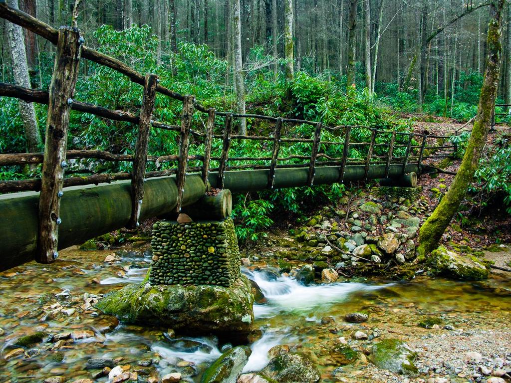
Those looking for more of a challenge can use the trails which climb more than 2000 ft up through the backcountry to the Appalachian Trail, forming a solid network from which you can explore the area. Along the way, you'll find beautiful old-growth forests, cascading streams and waterfalls, and serene mountainsides.
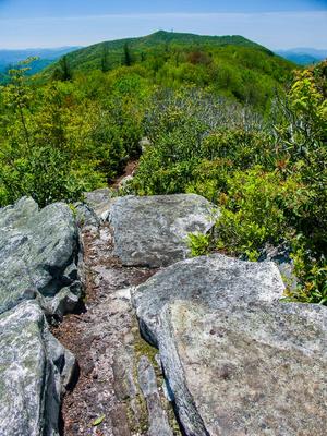
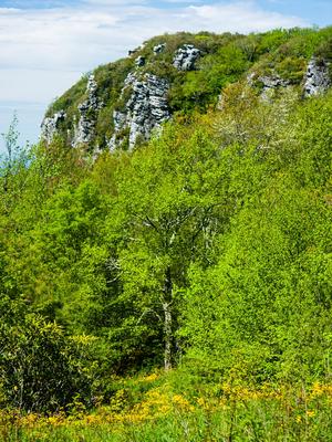
Once you reach the ridge, you're rewarded with amazing 360-degree views into both North Carolina and Tennessee. Features such as Blackstack Cliffs (with views into Tennessee), Whiterock Cliff (with views into North Carolina), and Baxter Cliff, as well as the exposed areas along Firescald Ridge and Jones Meadow (facing both states) provide excellent viewpoints.
But a good road climbing to the ridge at Jones Meadow and Camp Creek Bald, where there are even lookout towers, provides a jumping-off point for easier exploration of the high-elevation areas and views as well.
Hiking Trails

The Hickey Fork, Jerry Miller, Fork Ridge, and Green Ridge trails all connect from the valleys up to the Appalachian Trail. These are often used to make longer backpacking loops, perhaps by ascending one trail and descending another, and with an option to stay at the Jerry Cabin shelter.
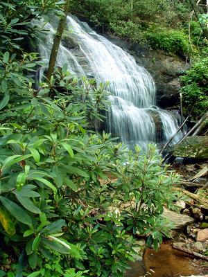
There are a few highly recommended shorter hikes in the area with great destinations too, though. One is the out-and-back to the Waterfall on the West Prong of Hickey Fork, accessible from the parking area on Hickey Fork Road in Shelton Laurel.
Another is a section of the A.T. starting from Jones Meadow - an old strip mine site - at the top of Viking Mountain Road and heading north, which provides a number of great view points along its length. This can be made into an elongated loop by using an alternate section of the A.T. This is one of the best hikes in the region called Firescald Knob.
And one longer loop - but still doable as a day hike - consists of a climb up the Hickey Fork trail, returning via the White Oak trail and FS 465 (with an optional out-and-back to Camp Creek Bald's summit). This one will include the waterfall an can be done in either direction.
This is just an overview of the trails in the area. For more information, visit the Trails page. For what we consider to be the best hikes using this network of trails, see the Shelton Laurel & Camp Creek Bald hikes page.
Facilities
Aside from the parking areas and the fire tower on Camp Creek Bald, there are no developed visitor facilities in the area. You will find most trails are signed and blazed; however, backcountry experience should be considered a requirement for accessing the more remote trails leading deeper into the area.
History

Many folks, especially those interested in local Civil War history, would be familiar with this area not because of its hiking trails, but because of what happened near here in the Winter of 1863. Dubbed the "Shelton Laurel Massacre", 13 civilian members of the Shelton family who originally settled the Big Laurel Creek valley were taken prisoner and killed by Confederate soldiers, accused of being Union sympathizers. You can find a good description of the story on this site, but be aware that it does generate a popup advertisement.
Take a hike here, and maybe gain a sense of what these mountain settlers were up against when they first arrived. Imagine attempting to carve a homestead, farm, and even a community out of the round coves and sharp ridges, and imagine doing it without power tools or electricty. Imagine how a community that struggled so hard, and was separated physically and mentally from the war by vast swaths of mountain wilderness, must have suffered by losing so many of their own to such a senseless act.
At Camp Creek Bald, more modern history becomes a point of interest. A former strip mine, the Jones Meadow site was being developed into a ski resort in the 1960's and early 1970's. At the site of the current parking area stood a lodge, and the meadows area was filled with dozens of rental houses, which extended all the way over to the area below Blackstack Cliffs.
The resort concept failed financially, in part due to the difficulty of accessing the mountaintop during bad weather. As of the late 1980's most structures had been removed, and none remain today (aside from the communications and fire towers on Camp Creek Bald itself). All that's left are the clearings and old road beds from the resort's construction.
Interactive Trail Map
Map Information
Download GPS Data
Click on a route, trail, or point on the map and select the GPS Data tab to download its data.
Data Formats
KML (Google Earth)
KML is the main file type used by Google Earth. If you have Google Earth installed, clicking the KML link should open the trail or point directly in Google Earth for viewing. This is the native file format used by Google Earth, but many other map applications can use and understand KML as well, so if you're not sure which one to download, KML is a good bet.
GPX
The GPX format stands for GPS Exchange - a free, open, XML format for exchanging GPS and map data. GPX is compatible with Google Earth, many other mapping programs, and most GPS devices (such as Garmin). Load the file directly into your GPS to help find your way on your next trip!
GeoJSON
GeoJSON is a newer, lightweight data exchange format which can be used to quickly share map data and may have a smaller size than KML or GPX. Many professional mapping and GIS applications support the GeoJSON format.
About the Map
Copyright
Base Layers
Base layers provided by OpenStreetMap, the US Geological Survey, the US Forest Service, and NC OneMap. Base layer images are subject to the respective copyright policies of their owners. Base layers may not be available at all times due to system maintenance or outages.
WNCOutdoors Base Layer
The WNCOutdoors Base layer is provided by WNCOutdoors.info. It is licensed by Creative Commons Attribution 3.0.
Trail and Marker Overlays
Trail layers and downloadable data are all original works created by WNCOutdoors with guidance from a variety of sources, including ensembles of our own GPS tracks, user contributed GPS tracks, official maps and GIS data from government agencies, and field observations. WNCOutdoors data is made freely available under the Open Database License - you are free to copy and use it for any purpose under the terms of that license (summary).
Tips
- Hover over a trail to see it highlighted. Helps to see start and end points for an individual trail.
- Scroll and zoom the map before printing, and that view will persist into the printed image.
- Click a trail for more details and to download it individually.
Directions
NC Hwy. 208 and NC Hwy. 212 east of Hot Springs serve the area around Shelton Laurel and Camp Creek Bald. From the junction of US 25/70 West, and NC 208 east of HotSprings, take NC Hwy. 208 for 3.5 miles to the junction with NC Hwy. 212.
Shelton Laurel Backcountry
There are two main roads that provide access to the Shelton Laurel Backcountry area: Hickey Fork and Big Creek. Both are signed along NC 212 (as Shelton Laurel Backcountry Area) with Forest Service brown signs. Both lead to Forest Service gravel roads and parking areas at the trailheads.
From the junction above, turn right; Hickey Fork Road is on the left after 6.8 miles, and Big Creek Road is on the left after 11.3 miles.
Camp Creek Bald Area
From the junction above, turn left; you'll reach the Tennessee state line in 5.8 miles. The road turns to TN 70. Continue 0.3 miles, and then turn right onto Viking Mountain Road. The road is paved for about 5 miles and then turns to gravel, and at some point becomes Bald Mountain Road. You'll reach Jones Meadow at the old strip mine, which was to be the resort area, at a junction about 8 miles from TN 70. To the right are the towers on Camp Creek Bald; to the left is a short stretch of pavement which ends atop Little Firescald Knob at a parking area.


