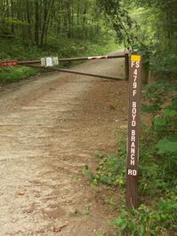
Boyd Branch Trail

At A Glance


0.7 mi one-way
Difficulty Rating: 0.7 ![]()
Steepness: Climbs Gently ![]()
Tread Condition: Few Obstacles ![]()
Blaze Color: Blue
Trail Number: 665
Description
Easy trail with a beautifully engineered creek crossing on the upper end. From Boyd Branch Road, the trail is graveled to the creek crossing, which also has a hard gravel bottom and large flat paving stones on either side. The rest of the trail is smooth and gently climbing through a young forest on an old road bed.
Can be combined with Boyd Branch Road to make a nice, short, easy loop hike.
This trail is located in the Bent Creek area. For a list of all the trails in that area, see the Bent Creek trails list page.
All Photos from the Trail


GPS Map
Map Information
Download GPS Data
Click on a route, trail, or point on the map and select the GPS Data tab to download its data.
Data Formats
KML (Google Earth)
KML is the main file type used by Google Earth. If you have Google Earth installed, clicking the KML link should open the trail or point directly in Google Earth for viewing. This is the native file format used by Google Earth, but many other map applications can use and understand KML as well, so if you're not sure which one to download, KML is a good bet.
GPX
The GPX format stands for GPS Exchange - a free, open, XML format for exchanging GPS and map data. GPX is compatible with Google Earth, many other mapping programs, and most GPS devices (such as Garmin). Load the file directly into your GPS to help find your way on your next trip!
GeoJSON
GeoJSON is a newer, lightweight data exchange format which can be used to quickly share map data and may have a smaller size than KML or GPX. Many professional mapping and GIS applications support the GeoJSON format.
About the Map
Copyright
Base Layers
Base layers provided by OpenStreetMap, the US Geological Survey, the US Forest Service, and NC OneMap. Base layer images are subject to the respective copyright policies of their owners. Base layers may not be available at all times due to system maintenance or outages.
WNCOutdoors Base Layer
The WNCOutdoors Base layer is provided by WNCOutdoors.info. It is licensed by Creative Commons Attribution 3.0.
Trail and Marker Overlays
Trail layers and downloadable data are all original works created by WNCOutdoors with guidance from a variety of sources, including ensembles of our own GPS tracks, user contributed GPS tracks, official maps and GIS data from government agencies, and field observations. WNCOutdoors data is made freely available under the Open Database License - you are free to copy and use it for any purpose under the terms of that license (summary).
Tips
- Hover over a trail to see it highlighted. Helps to see start and end points for an individual trail.
- Scroll and zoom the map before printing, and that view will persist into the printed image.
- Click a trail for more details and to download it individually.
Feedback
Ratings
Average Rating: (rated 0 times)
Rate It Now:

[Site Admin] Jordan M. said: Billy: good idea, and eventually we hope to do just that. If we had enough time, we'd put directions to each trailhead for each trail in the entire network. To start, we're focusing on heavily-used trails that we call our best Hikes and Rides. Thanks for your comments!
billy said: Directions would be nice. I know you have the gps stuff. But gps is lame when you don't own a gps device. Give me a topo trail map anyday and I'll be in heaven. But definitely a huge thank you for putting this stuff together. you Rock!!!