Spencer Branch Trail

At A Glance


2.3 mi one-way
Difficulty Rating: 2.3 ![]()
Steepness: Climbs Moderately ![]()
Tread Condition: Moderately Rough ![]()
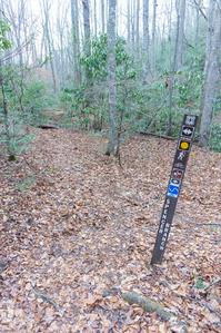
Blaze Color: Yellow
Trail Number: 140
Description
The upper end of this trail, above FS 5097 (Neverending Road), was recently rerouted onto a much more reasonable grade with a few switchbacks, to replace the old, extremely steep and rocky drop down from Trace Ridge. It's now an easy climb or descent.
The middle section is a more typical streamside trail, with some muddy, wet, and rocky spots.
At the junction with Fletcher Creek, the trail crosses the stream. There used to be a log bridge farther downstream near the junction with Middle Fork, but that washed away in 2004 and was never replaced. You may be able to cross on stepping stones, but only when the water is fairly low.
Downstream from the Middle Fork trail junction, Spencer Branch crosses Middle Fork. That bridge is also out, making for another tricky crossing. Beyond the Middle Fork crossing, the trail enters a narrow gorge as it follows the creek downstream
The trail receives a lot less usage on this stretch. Although not steep, the precipitous trail clings to the steep sides of the cove in places, only a foot (or less) wide with nearly vertical slopes on either side. It threads through corridors of mountain laurel and rhododendrons in some stretches and follows an old logging railroad grade in others. There are some nice sliding cascades on the stream.
There is one more creek crossing which should be easy to rock-hop (unless the water is high) before the junction with the Big Creek trail at the Hendersonville Reservoir. Keep left to finish the Spencer Branch trail on Hendersonville Reservoir Road just below the dam.
Directions
Spencer Branch trail connects to Trace Ridge trail at its upper end, and the old Hendersonville Reservoir Road at its lower end, about 1.4 mi from the Trace Ridge trailhead parking.
Intersecting Trails
This trail is located in the Mills River area. For a list of all the trails in that area, see the Mills River trails list page.
All Photos from the Trail


GPS Map
Map Information
Download GPS Data
Click on a route, trail, or point on the map and select the GPS Data tab to download its data.
Data Formats
KML (Google Earth)
KML is the main file type used by Google Earth. If you have Google Earth installed, clicking the KML link should open the trail or point directly in Google Earth for viewing. This is the native file format used by Google Earth, but many other map applications can use and understand KML as well, so if you're not sure which one to download, KML is a good bet.
GPX
The GPX format stands for GPS Exchange - a free, open, XML format for exchanging GPS and map data. GPX is compatible with Google Earth, many other mapping programs, and most GPS devices (such as Garmin). Load the file directly into your GPS to help find your way on your next trip!
GeoJSON
GeoJSON is a newer, lightweight data exchange format which can be used to quickly share map data and may have a smaller size than KML or GPX. Many professional mapping and GIS applications support the GeoJSON format.
About the Map
Copyright
Base Layers
Base layers provided by OpenStreetMap, the US Geological Survey, the US Forest Service, and NC OneMap. Base layer images are subject to the respective copyright policies of their owners. Base layers may not be available at all times due to system maintenance or outages.
WNCOutdoors Base Layer
The WNCOutdoors Base layer is provided by WNCOutdoors.info. It is licensed by Creative Commons Attribution 3.0.
Trail and Marker Overlays
Trail layers and downloadable data are all original works created by WNCOutdoors with guidance from a variety of sources, including ensembles of our own GPS tracks, user contributed GPS tracks, official maps and GIS data from government agencies, and field observations. WNCOutdoors data is made freely available under the Open Database License - you are free to copy and use it for any purpose under the terms of that license (summary).
Tips
- Hover over a trail to see it highlighted. Helps to see start and end points for an individual trail.
- Scroll and zoom the map before printing, and that view will persist into the printed image.
- Click a trail for more details and to download it individually.
Trail Segments
Trails are often made up of several connecting paths which may have different characteristics, allowed uses, and seasons. This trail is divided into multiple segments as follows:
Spencer Branch - Spencer Gap to Neverending Rd.
- Allowed Uses: Hiking, Mountain Biking, Horseback Riding
- Length: 1.16 mi
Spencer Branch - Neverending Road to Fletcher Ck. Tr.
- Allowed Uses: Hiking, Mountain Biking, Horseback Riding
- Length: 0.88 mi
Spencer Branch - Fletcher Creek to Middle Fork Tr.
- Allowed Uses: Hiking, Mountain Biking, Horseback Riding
- Length: 433 ft
Spencer Branch - Middle Fork Tr. to Big Creek Conn.
- Allowed Uses: Hiking, Mountain Biking, Horseback Riding
- Length: 0.86 mi
Spencer Branch - Big Creek Conn. to Hendersonville Reservoir Road
- Allowed Uses: Hiking, Mountain Biking, Horseback Riding
- Length: 287 ft
Total Calculated Length: 3.04 mi
This value is derived from our underlying map data, and it may not match officially published information.
Feedback
Ratings
Average Rating: (rated 0 times)
Rate It Now:

No comments yet.