Big East Fork Trail

At A Glance


3.6 mi one-way
Difficulty Rating: 3.6 ![]()
Steepness: Climbs Moderately ![]()
Tread Condition: Moderately Rough ![]()
Trail Number: 357
Description
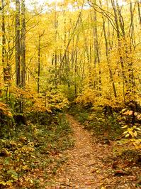
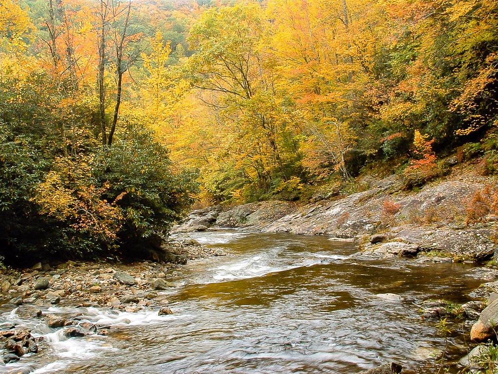
Follows the Big East Fork Pigeon River. Pristine river scenes. Trail is wide and heavily used near beginning; diminishes somewhat the further you travel. Ends at the junction with Greasy Cove Prong and Bridges Camp Gap trails, providing long loop options in the Shining Rock Wilderness.
Intersecting Trails
This trail is located in the Shining Rock Wilderness area. For a list of all the trails in that area, see the Shining Rock Wilderness trails list page.
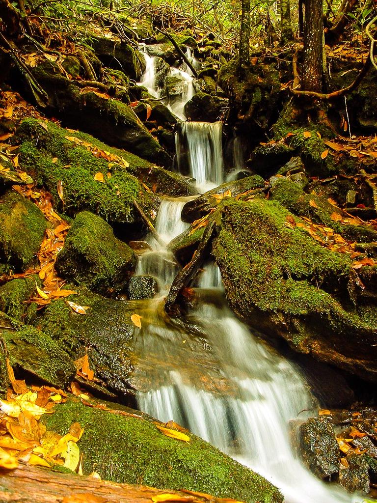
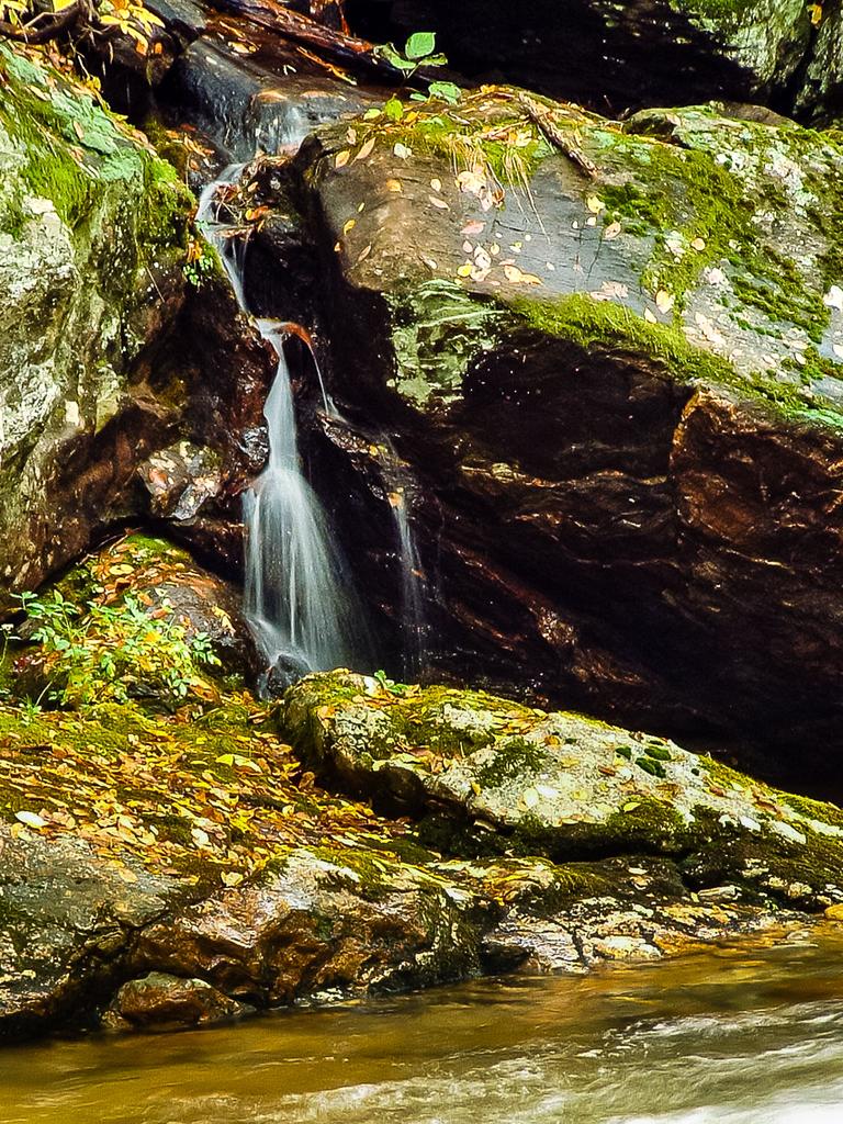
All Photos from the Trail


GPS Map
Map Information
Download GPS Data
Click on a route, trail, or point on the map and select the GPS Data tab to download its data.
Data Formats
KML (Google Earth)
KML is the main file type used by Google Earth. If you have Google Earth installed, clicking the KML link should open the trail or point directly in Google Earth for viewing. This is the native file format used by Google Earth, but many other map applications can use and understand KML as well, so if you're not sure which one to download, KML is a good bet.
GPX
The GPX format stands for GPS Exchange - a free, open, XML format for exchanging GPS and map data. GPX is compatible with Google Earth, many other mapping programs, and most GPS devices (such as Garmin). Load the file directly into your GPS to help find your way on your next trip!
GeoJSON
GeoJSON is a newer, lightweight data exchange format which can be used to quickly share map data and may have a smaller size than KML or GPX. Many professional mapping and GIS applications support the GeoJSON format.
About the Map
Copyright
Base Layers
Base layers provided by OpenStreetMap, the US Geological Survey, the US Forest Service, and NC OneMap. Base layer images are subject to the respective copyright policies of their owners. Base layers may not be available at all times due to system maintenance or outages.
WNCOutdoors Base Layer
The WNCOutdoors Base layer is provided by WNCOutdoors.info. It is licensed by Creative Commons Attribution 3.0.
Trail and Marker Overlays
Trail layers and downloadable data are all original works created by WNCOutdoors with guidance from a variety of sources, including ensembles of our own GPS tracks, user contributed GPS tracks, official maps and GIS data from government agencies, and field observations. WNCOutdoors data is made freely available under the Open Database License - you are free to copy and use it for any purpose under the terms of that license (summary).
Tips
- Hover over a trail to see it highlighted. Helps to see start and end points for an individual trail.
- Scroll and zoom the map before printing, and that view will persist into the printed image.
- Click a trail for more details and to download it individually.
Feedback
Ratings
Average Rating: 5.0 (rated 2 times)
Rate It Now:

Mary Hartigan said: The floods last year destroyed parts of the trail about 1-1.5 mi from the 276 entrance. We had to stop when it hit a big patch of unstable rock scrambling. Anyone know of any efforts to rebuild?
Tanya Neplioueva said: Beautiful hike. The trail is technical, but moderate with a total elevation gain around 1,100 feet. There are countless spots to relax by the river, crystal clear (but cold!) swimming holes, and adjoining waterfalls. There are a few places the trail splits, follow the larger path. We were there in March of 2019 and somebody has helpfully marked the trail with neon orange tape blazes.
Steven FitzGerald said: what a stream! it reminded us of our trip to glacier national park. gin-clear water flowing boisterously between boulders and over multi-colored rocks... we could easily see the stream bottom in five-foot deep pools... we only ventured about 1/2-mile from the trailhead on our scouting voyage, but we will return soon and often; and of course, with the fly rod... verified bobcat sightings are another reason... thankfully we recently moved to candler, so we're only 45 minutes away...