Hikes in the Blue Ridge Parkway Section 5 Trailhead Area
Here is a list of hikes in the Blue Ridge Parkway Section 5 Trailhead area.
Each of the hikes has its own printable guide page with all the information and links, including (where available):
- directions to the starting point
- difficulty
- length
- elevation change
- a map
- photos from along the way, and
- a detailed description and trail directions.
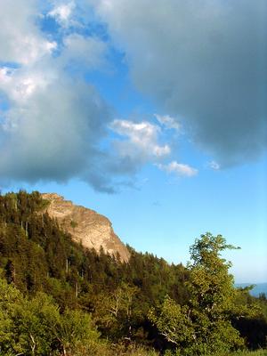
Devil's Courthouse Hike


- This hike takes you to the summit of Devil's Courthouse, a high-elevation rocky summit with a fantastic cliff-top overlook. But this isn't the usual route used by most casual tourists, which is a paved trail starting at a Parkway overlook. Rather,...
- 4.3mi, Climbs Moderately
- Tread Condition: Moderately Rough
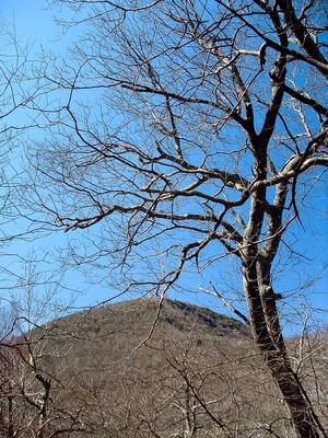
Mount Pisgah Hike
- A classic Blue Ridge Parkway hike, this trail continues onto National Forest land to climb to the summit of one of the area's most well-known peaks, which lends its name to numerous other things throughout the region. Mount Pisgah is part of the...
- 3mi, Climbs Moderately
- Tread Condition: Moderately Rough
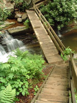
Skinny Dip Falls Hike
- This moderate, short hike takes you to an appealing waterfall and swimming hole on the Yellowstone Prong of the Big East Fork of the Pigeon River. It makes a great summer swimming destination, a great way to stretch your legs if you're traveling the...
- 0.8mi, Climbs Moderately
- Tread Condition: Moderately Rough

