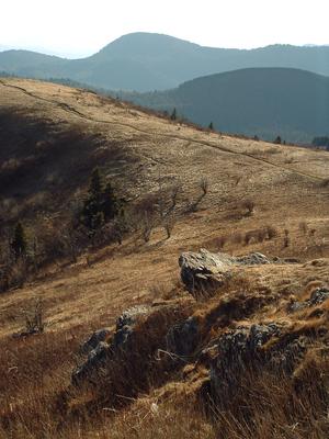
Starting at Black Balsam Road and going generally north, this is one of the most popular stretches of the Art Loeb trail as it crosses over the 6,214 ft summit of Black Balsam Knob. It then winds along the side of the ridge before crossing the summit...
This short section of the longer Art Loeb trail climbs from the Daniel Boone Boy Scout Camp on the Little East Fork of the Pigeon River, up to Deep Gap on the ridge between Shining Rock and Cold Mountain. It's steep, with A spur trail leads to the...
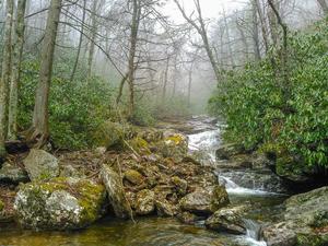
Follows the Big East Fork Pigeon River. Pristine river scenes. Trail is wide and heavily used near beginning; diminishes somewhat the further you travel. Ends at the junction with Greasy Cove Prong and Bridges Camp Gap trails, providing long loop...
This trail follows a ridge line south of Cold Mountain for its first half, and then traverses to the west of the mountain before climbing to another ridge and ascending the mountain’s western flank. The top of Cold Mountain has plenty of trees on...
This trail follows the ridgeline and ascends and descends frequently over several mountain tops most notably Birdstand Mountain. From the top of these mountains the view can be obscured by trees but the few glimpses you get will show vistas of the...
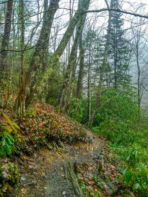
This trail initially traverses Grassy Cove Ridge at or near its crest, with minimal views other than of the Parkway, until it drops down to Greasy Cove Prong. Caution: The trail is especially difficult to see during this descent. It follows the prong...
Access is past Daniel Boone Boy Scout Camp off of NC 215 near Bethel, NC. Continue on SR 1129 to trailhead. Please notify camp staff if you are going to leave a vehicle at the camp.
This trail follows Chestnut Ridge and crosses several knobs that provide nice views of the surrounding Shining Rock Wilderness. In the first half mile after leaving Shining Creek Trail, it climbs very steeply, gaining about 1,400 feet of elevation,...
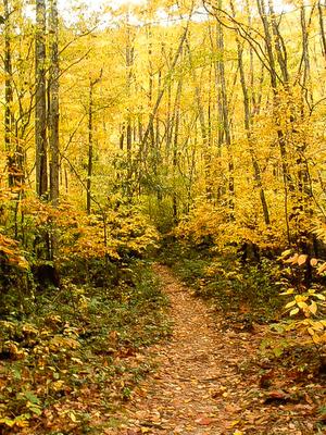
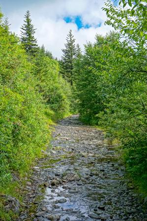
This trail follows Shining Creek for the majority of its length. There are plenty of good spots to leave the trail and view undisturbed pools of green water or look upon steep slopes with plentiful, tall trees. The trail ends with multiple traverses...
3.4mi, Climbs Steeply, Moderately Rough
Nearby Trails
The following trails cross into this trailhead area, but are primarily accessed from another trailhead:
Starting on the Parkway in a mixed hardwood/spruce forest, the trail descends over a somewhat rocky path on an easy grade. You'll hear the river in the valley below. The trail passes through one switchback to the left and then into a wetter forest...
Similar to the Flat Laurel Creek trail, this trail follows an old railroad grade. It travels around Black Balsam and Tennent Mountains. It is level or climbs gently in places. It is very rocky and very wet, although there are no sizeable stream...
**Waterrock Knob to Pisgah Inn**
From Waterrock Knob to Flat Gap, the trail follows the Blue Ridge Parkway closely at most times. It gains some distance from the motor road on the southwest slope of the ridge line from there to Haywood Gap.
From...