The Best Hikes to Waterfalls
Hikes By Features : Waterfalls | Views | Historic Sites | Kids and Families
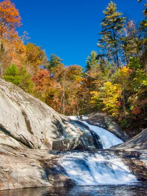
Here's a collection of what we consider to be the best waterfall hikes in the Western North Carolina region.
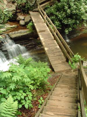
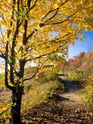
One of the most popular destinations for hiking in the mountains, waterfalls abound in the southern Appalachians, with ample rainfall falling on erosion-resistant rocks underlying the smooth, round ridges. Waterfalls are a common feature on both smaller streams and larger rivers.
There's a reason a part of Western NC is called the Land of Waterfalls!
While we consider these the best hikes in the region that include a waterfall, they are by no means an exhaustive list of all the waterfalls you can hike to. For ALL the waterfalls we know about in Western North Carolina, visit our sister site, WNCWaterfalls.info !
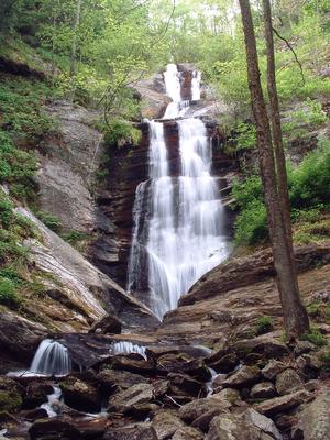
Toms Creek Falls Hike
This easy hike is excellent for families and children, with a reward at the end that everyone will look forward to. It's short enough that adults who have to carry tired kids won't be too worn out at the end to enjoy it themselves. The waterfall...
0.8mi, Climbs GentlyTread Condition: Graveled
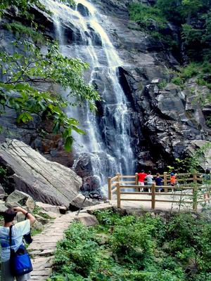
Hickory Nut Falls Hike
This moderate hike takes you out-and-back through a vibrant forest to the base of Hickory Nut Falls. This is a very high and neat waterfall. You'll travel along the base of the cliffs that form the edge of the Hickory Nut Gorge and the Falls. Trees...
1.5mi, Climbs GentlyTread Condition: Some Obstacles
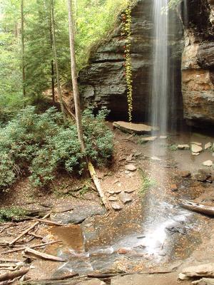
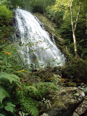
Douglas Falls (Lower Approach) Hike
This spectacular, 70 ft. falls is located in an old-growth forest. The lower approach to the falls is a walk on a gently sloped trail to its base. The hike is markedly changed from years past; though the hemlocks in the area are dead, you'll travel...
1mi, Climbs GentlyTread Condition: Moderately Rough
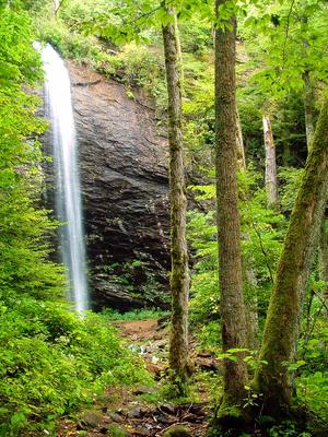
Moore Cove Falls Hike
This showery plunging waterfall is located in one of the most popular areas of the Pisgah National Forest, near the Davidson River in the "Land of Waterfalls". It's a delightful, beautiful walk thru fern-filled woods. And it's easy enough for...
1.4mi, Climbs GentlyTread Condition: Few Obstacles
Skinny Dip Falls Hike
This moderate, short hike takes you to an appealing waterfall and swimming hole on the Yellowstone Prong of the Big East Fork of the Pigeon River. It makes a great summer swimming destination, a great way to stretch your legs if you're traveling the...
0.8mi, Climbs ModeratelyTread Condition: Moderately Rough
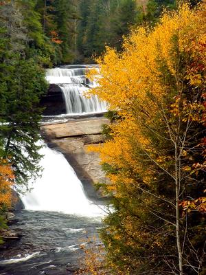
Dupont Waterfalls and Lakes Tour Hike
On this hike, you'll visit up to 5 of the 6 major waterfalls and 3 of the beautiful lakes in Dupont State Forest. It starts as an easy path to some of the most spectacular waterfalls in the area: Hooker, Triple, and High Falls. Covered picnic...
0.75 - 10.0mi, Climbs ModeratelyTread Condition: Some Obstacles
Tuckasegee High Falls Hike
There's a lot of neat things to see packed into this relatively short, 0.7 mi path. Even if the trail *didn't* start at a beautiful swim-worthy mountain lake and recreation area (it does), and even if it didn't pass a beautiful 60 ft waterfall along...
1.4mi, Climbs SteeplyTread Condition: Some Obstacles
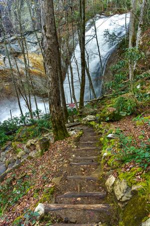
Crabtree Falls Hike
This popular, short loop descends on a moderate path to a majestic 70 ft waterfall, which is widely touted as one of the most photogenic in the area. You'll climb steeply up the opposite ridge for a short distance, then hike a wide, smooth trail...
3mi, HillyTread Condition: Some Obstacles
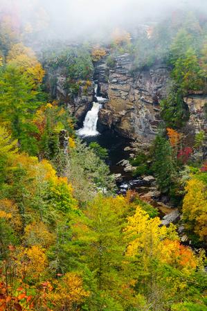
Linville Falls - Erwin's View Hike
Linville Falls has two main trails: Erwin's view and Plunge Basin. Erwin's view is the easier of the two, and stops at three main overlooks: Upper Falls, Chimney View, and the eponymous Erwin's View. This trail passes through a majestic forest of...
1.5mi, Few HillsTread Condition: Some Obstacles
Graveyard Fields Hike
A unique loop trail winds through this high-elevation, flat valley. Two spurs lead to some of the most photographed and enjoyed waterfalls in the state! You'll pass through open areas, stands of Mountain Laurel and Rhododendron, and young northern...
3.2mi, HillyTread Condition: Some Obstacles
Stone Mountain Loop Hike
Passing three of the most sought-out points in the park - the summit of Stone Mountain, the Hutchinson Homestead, and Stone Mountain Falls - this hike is as varied as the park itself. A moderate climb through open, pleasant woods gives way to more...
4.5mi, HillyTread Condition: Moderately Rough
Panthertown Valley Tour Hike
This is a large loop with a wide variety of main attractions. The trails will take you past lazy, meandering streams with clean white sandbars, yet you'll discover 5 major waterfalls as well. You'll explore the unusual, flat-bottomed, high-elevation...
8.8 - 10.0mi, HillyTread Condition: Moderately Rough
Flat Laurel Creek Hike
This loop takes you around the headwaters basin of Flat Laurel Creek, which starts in a unique, high-elevation valley surrounded by sharp peaks, grassy balds, and cool, dark, spruce-fir forests. Its elevation is over 5300 ft at the bottom, and it...
2.5mi, Climbs GentlyTread Condition: Moderately Rough
Harper Creek Falls Hike
A wilderness experience awaits along Harper Creek. This is not your typical, easy hike to Harper Creek Falls. However, this is a relatively gentle encounter with wilderness due to its short length, moderate grade, and sparse (but useful) trail...
8.5mi, HillyTread Condition: Very Rough