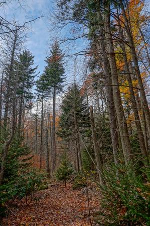
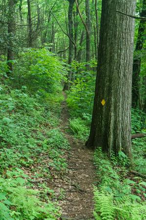
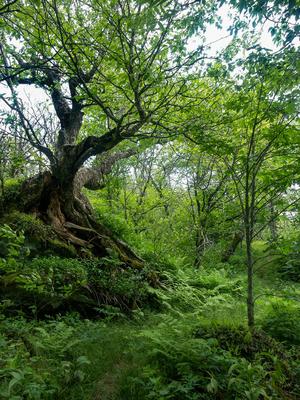
From FS 472 the trail starts its climb on an old road bed, but soon veers left onto a narrow path for the first of many switchbacks as it ascends the ridge. The switchbacks ensure the grade is never too extreme as it traverses the steep slope many...
**📝 Note**: The length of this trail is up for debate; see below.
From Bolens Creek's north end at about 3050 ft elevation, this trail follows a recognizable old Forest Service road before becoming more of a foot trail following a more ancient...
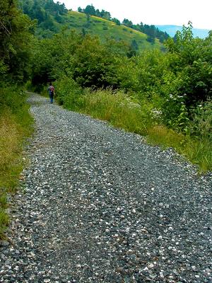
This trail circles around the Briar Bottom Group Campground and runs through a partially-surviving hemlock stand beside the South Toe River. Has a mostly gravel surface. Provides access to the Mount Mitchell, Setrock Creek Falls, and River Loop...
This is the third-longest trail in the Appalachian District, after the Appalachian Trail and Mountains to Sea Trail. It also has one of the highest average elevations of any trail in the region, with a long stretch above 5000 ft topping out at about...
On clear days the trail has great views of Table Rock, Grandfather and Roan mountains. The trail ascends gently for the first half mile and then climbs steeply toward the terminus at Deep Gap with switchbacks near the top. The trail ends at a flat...
This short trail is located at Black Mountain Campground and passes through a beautiful mixed hardwood forest and by some magnificent boulders. Starting at the amphitheater, the trail goes right and immediately splits left from the River Loop trail....
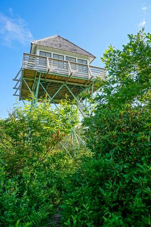
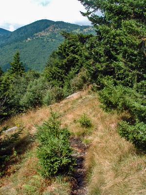
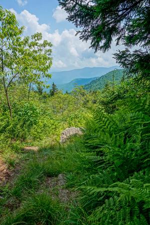
This trail follows a ridge line to the Green Knob Lookout Tower at 5,090 feet. The trail is very steep and gets rocky so some minor scrambling is required. The trail provides amazing views of this beautiful mountainous region. After 2.8 miles the...
This trail branches off from the Mount Mitchell Trail. The trail gently climbs Higgins Bald where old cabin foundations exist. It breaks off to the left from the Mount Mitchell trail after about 1.5 miles and rejoins the yellow blazed Mount Mitchell...
**Black Mountain Campground to Beacon Heights**
From Black Mounain Recreation Area by South Toe River in Pisgah NF to Buck Gap at BRP mp 344.1: Climbs the ridge. From Buck Gap at BRP mp 344.1 (NC-80) to Woodlawn Park (US-221): The MST leaves the...
River Loop trail is a double-lollipop shaped trail with two loops on each end: the north and south. The Black Mountain Campground sits near the middle.
### Southern (Upstream) Loop
The southern, or "upstream" loop, located southwest of the Black...
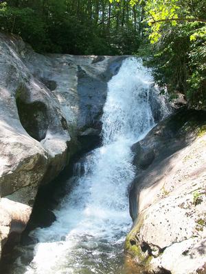
Follows Roaring Fork Creek along FS 5520 and then up a short side path to the falls. This trail, being short and mostly easy, with just a few obstacles near the falls, is highly recommended!
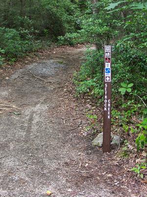
The trail itself is a short climb up beside Setrock Creek through a hardwood & hemlock forest to the base of Setrock Creek Falls. Mostly easy, with a few rocks & roots to scurry over or around. There is a nice place to hang out and wade at...
This is an easy walk on a gently sloping gravel road to a historic logging, and later, tourist camp site below the summit. Starts at Stepps Gap at the Park Office. Provides spectacular views of Mount Mitchell and the mountains below. Passes through...
This long, strenuous trail leads from the USFS Black Mountain Campground to the summit of its namesake mountain. Most of the trail is on USFS property. Climbs 3600 ft in 5.5 mi, making it one of the highest single-trail climbs in the region. It's...
**Pisgah Inn to Black Mountain Campground**
Pisgah Inn, BRP mp 408.6 to Folk Art Center, BRP mp 382: from the Pisgah Inn to the Mount Pisgah Parking Area, the trail is co-signed as the Buck Spring trail. This leads past the old Buck Spring Lodge...
This narrow trail is extremely steep and follows the slope more or less directly uphill. However, it is short. The bottom portion climbs over a rock jumble and the middle section has more of a dirt tread. The trail passes through several openings,...