Trails in the Pilot Mountain State Park Trailhead Area

Here is a list of all trails in the Pilot Mountain State Park Trailhead area.

Each trail has its own printable page with all the information and links, including (where available):

  • directions to the starting point
  • difficulty
  • length
  • elevation change
  • a map
  • photos from along the way, and
  • a detailed description and trail directions.

For general information about the Pilot Mountain State Park trailhead, see the Pilot Mountain State Park Trailhead page.

Need to find trails by another method? Go back to Trails.

Bean Shoals Canal Trail

Easy
  • A moderately sloped trail on the north shore of the of the Yadkin river that begins at the turnaround parking area. This trail weaves along a railroad trestle, as well as along the ruins of the unfinished Bean Shoals Canal. (Note: The railroad track...
  • mi, , Some Obstacles

Mountains to Sea Section 7 Trail

Most Difficult
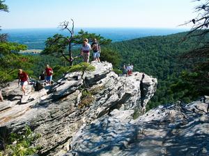
  • **Pilot Mountain State Park to Hanging Rock State Park** From Surry County boundary through Stokes County: (This section includes 7 miles of trails in Hanging Rock State Park.) The Sauratown Trail that connects Pilot Mountain to Hanging Rock has...
  • 36.0mi, Hilly, Moderately Rough