Maps
One of the things you should not be without on your hike is a good map. Maps let you orient yourself to the terrain before heading out, and can help you stay on the path once you hit the trails.
Traditionally, when you needed a map, you got printed paper product that you simply folded up and carried with you on the trail. And that may still be the best way to use a hiking map in many situations. But now, of course, a variety of digital products are available as well, featuring convenient downloads, faster updates, and high precision and accuracy.
Here's a collection of maps - including ones we've produced and ones produced by 3rd parties - that can be viewed, downloaded, printed, or purchased before your hike.
Digital Maps
HikeWNC's Maps
Interactive Overview Map
Start with a Western North Carolina Area Overview Map, showing the locations of major trailheads in the region.
Interactive Maps with GPS Data
Here's an index of our interactive GPS on this site. Each map is based on Google Maps, providing its familiar interface and features, and has downloads for the GPS data so you can put it on your device and take it with you on your next trip. Provides roads, shaded relief, high-resolution aerial imagery, and topo map layers.
Avenza PDF Maps
Avenza, a Canadian mapping company, produces a fantastic mobile map application which allows you to download many of the map products listed below as geographically enabled PDF files onto your mobile device. The maps, which are in-app purchases from their Map Store, allows you to view maps offline and track your location as you move. You can annotate maps with points of interest and photos, record your GPS tracks, easily measure distances, and import and export data.
Get the Avenza PDF Maps app in the iOS App Store for Apple devices, or the Google Play Store for Android devices. Then visit Avenza's Map Store on the web or in-app to purchase base maps.
Printed & Other Local/Regional Maps

Digital maps and the Avenza PDF Maps app are great tools and ways to utilize modern technology. However, keep in mind that mobile devices still have limited battery capacity and using GPS to track location can deplete it very quickly. Most are not waterproof and susceptible to damage from drops, falls, water damage, and so on. So we recommend also having a printed map for longer hikes or overnight trips.
Here's a collection of what we consider to be the best map available for this purpose.
DeLorme North Carolina Atlas and Gazetteer
This old stand-by is a good option for regional planning and to keep in the car. It even has enough detail to show some of the topography and hiking trails - albeit at a fairly large scale. It fits nicely in between a regular road atlas/state map and actual trail maps. For those, see below.
Pisgah Map Company - WNC Trail Guides
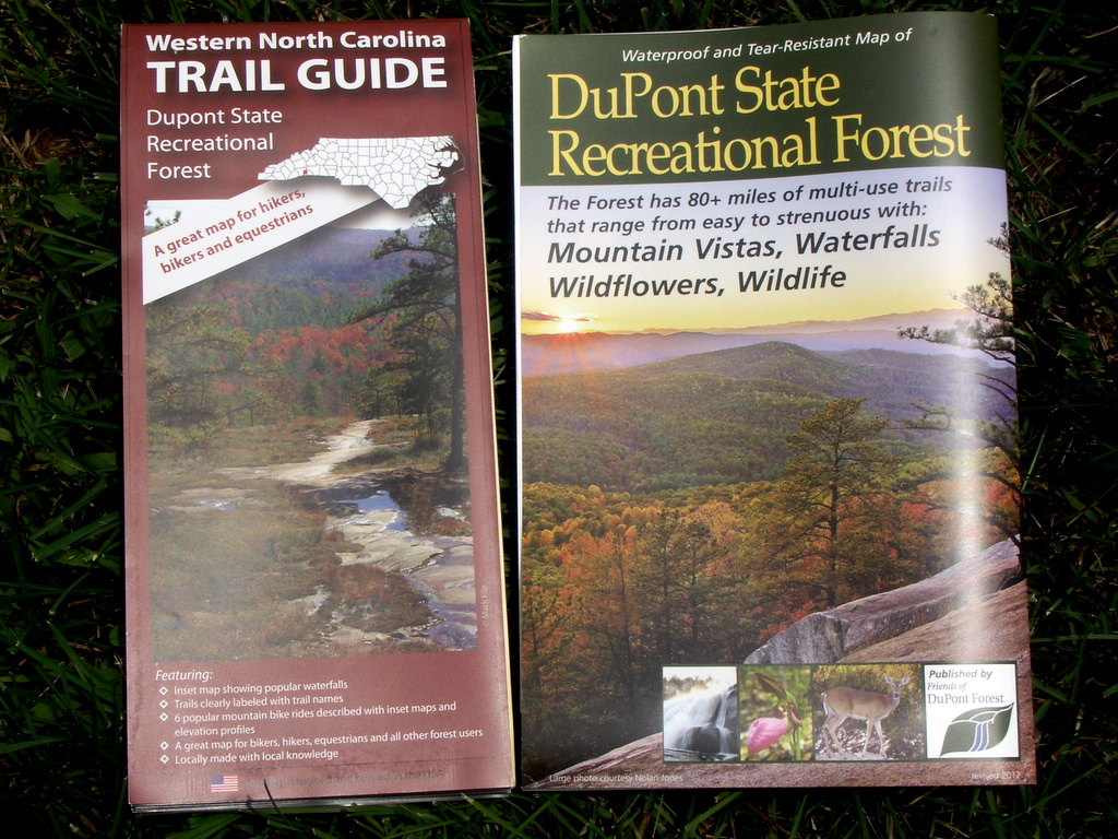
Pisgah Map Company has released an exciting new series of maps under the title "Western North Carolina Trail Guide". Right now, there are three main maps in the WNC Trail Guide series: South Pisgah Ranger District, DuPont State Forest, and Grandfather Ranger District.

Compared to the older Trails Illustrated maps, Pisgah Map Company's maps have more detail, more accuracy, are more up-to-date, and have some great extra guide information as well.
The award-winning South Pisgah Ranger District map was a worthy competitor to the Trails Illustrated Pisgah Ranger District map (#780) when it was released. And with each revision of that map, not to mention their release of more maps in the WNC Trail Guide series, Pisgah Map Company's maps have started to become the go-to product for hikers in the region.
Read our review of the Pisgah map on the blog, and be sure to pick up a copy before your next hike in Pisgah or DuPont State Recreational Forest. They are available as printed maps, or as digital downloads in the Avenza PDF Maps store. These are highly recommended!
Friends of DuPont Forest - Dupont State Recreational Forest Map
Friends of DuPont Forest publishes a good Recreation Guide map of all of Dupont State Recreational Forest. The printed version is a large, folded 17" x 22" sheet on waterproof PolyArt synthetic stock, and a digital version is available in the Avenza PDF Maps store.
This map features shaded relief, marked major water crossings, a trail rating system with distances, driving directions from regional cities, and a summary and directions to major attractions, and is revised regularly.
Profits from map sales are used to support conservation, education, and recreational activities in DuPont State Recreational Forest.
Buy the DuPont State Recreational Forest Map (or look for it in the Avenza Map Store).
Slickrock Expeditions - Map of the Panthertown Valley
Slickrock Expiditions publishes an excellent, large-scale trail map of the Panthertown Valley area. A "feature" of this maps is its depiction of all trails in the valley - official or not. You can purchase a map from their web site for $12, and it is also available in many local outfitters.
Buy the Map of Panthertown Valley by Slickrock Expeditions
National Geographic - Trails Illustrated Series
National Geographic's "Trails Illustrated" series of maps, covering much of Western North Carolina's best hiking areas, has for many years been one of the best options hikers have for a recreational trail map. These are available in printed and digital form as well.
More about Trails Illustrated maps
USGS - Topographic Quadrangle Maps
The United States Geological Survey (USGS) has produced its topographical quadrangle maps for over a century. These maps were the staple of outdoor recreationalists until only very recently, when maps more specific to outdoor recreation started being produced.
This page contains information on these topographic maps once published by the US Government, how they are used on this site, and how you can obtain them online for free and in paper form as well. Their newest product, a digital quadrangle map format called US Topo, is also available as downloadable PDF files, and as free downloads in the Avenza PDF Maps store.
Most of these printed maps can be picked up on your way to the trails by stopping by one of WNC's fine outdoor outfitters!


