Western North Carolina Trails
This section includes details about all the individually named trails in the vast network of them that blankets the mountains of Western NC. Each trail listing has its own bookmarkable page to make it easy to find later, with all of its stats, photos, and a map (where available).

Search for a trail now if you know its name.

Featured Trails
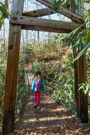
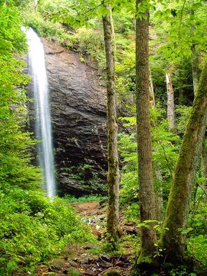
Andy Cove Nature Trail


Trails vs Hikes
A trail is different from a hike in that a hike may use more than one trail, only part of a trail, or roads to connect between different trails.
If you just want the details needed to go take a hike, start with our Best Hikes section for full and complete guides that stitch trails together into a great trip, including directions, maps, descriptions, and photos. Although some trails do make great hikes, sticking to a single named trail like you'll find on these pages doesn't always make for the best experience.
The trail listings below are most useful for researching raw information from our database to make up your own day hikes or overnight loops out of the trail network.
Find a Trail
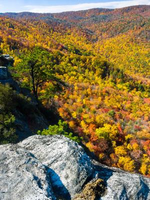
Big Lost Cove Cliffs Trail

By Location
To find trails by location, visit the Trailheads section of the site. Each Trailhead has a listing of all the trails (and hikes!) in the network near that location.
List of All Trails
You can also browse a list of all trails.
By Search
You can search for a trail if you know its name.
About Our Trail Listings
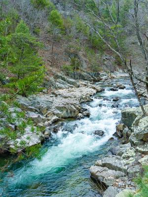
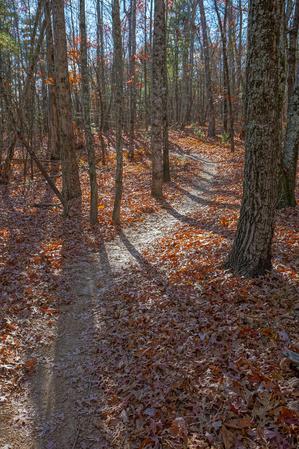
Laurel River Trail


Trails are listed by their official name given by the managing land agency. We list, where available, the steepness, tread condition, and overall difficulty of the trail, as well as its length and overall elevation change.
Length
Trail length is one-way. If you are hiking a single trail out-and-back, then double the length. While some guides show the round-trip length by default, many people's hikes combine trails or use only portions of trails, so the most accurate thing for us to do is just list a trail's actual length.
Difficulty Ratings
The US Forest Service, among others, separates trails into just three difficulty levels. We think that's a bit condensed given the variety of trails we have in our region. Even ski slopes usually have at least 4 difficulty ratings!
So, we have devised four difficulty levels for all of the trail and hike listings on this site. Here's a description of typical conditions you might find on hikes with a given difficulty level.
North Slope Trail
")
Douglas Falls Trail
Hickory Mountain Loop Trail

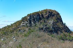
Table Rock Summit Trail
Mountains to Sea Section 3 Trail

Easy |
Gentle climbs and descents with a relatively smooth surface, sometimes on pavement or other trail structures. No tricky water crossings or exposed cliffs. Some trails may be wheelchair and stroller accessible. Family-friendly meaning almost anyone including smaller children should be able to complete these. |
Moderate |
Some climbs and descents with a few obstacles on the trail surface. May contain water crossing that are not overly difficult and occasional exposure to drop-offs beside the trail that aren't too risky. Most people with some experience hiking, including older children, should be able to complete these. |
More Difficult |
Significant climbs and descents with considerable elevation change, but short of the hardest trails in the region. A trail surface that can be somewhat rough in places, but short of dangerous climbing or rock scrambling. May contain tricky water crossings and some exposure to cliffs and drop-offs beside the trail. Experienced hikers in good shape should be able to complete these. |
Most Difficult |
Large climbs and descents with high elevation change. A trail surface that can be very rough in places, including possibly dangerous exposure to cliffs and drop-offs, and rock scrambling. May contain very tricky water crossings. Only experienced hikers in excellent shape should attempt to complete these, which are among the most difficult in the region. |
Steepness
The Steepness rating factors in the way in which a trail's elevation is achieved. This does not take in to effect the overall elevation change on the trail (which is listed separately). Very short sections of the trail that are out-of-character for the rest don't affect this rating, but will be mentioned in the description.
| Level | No appreciable elevation change along the length of the trail. The trail may not be completely flat, but it is atypically so for the mountain region. |
| Climbs Gently | Gentle climb, can be done at a normal hiking pace, ending at a higher or lower elevation from one end to the other. No sections are considered steep. |
| Climbs Moderately | Moderate climb, which may slow a normal hiking pace slightly, ending at a higher or lower elevation from one end to the other. Some sections may be moderately steep, but the trail is not extremely so overall. |
| Climbs Steeply | Steep climb, which considerably slows a normal hiking pace, ending at a higher or lower elevation from one end to the other. Some sections may be extremely steep, and the trail may be very steep overall. |
| Few Hills | Gentle to moderate climbs both up and down, but with both ends at roughtly the same elevation. The hills may slightly slow a hiking pace. |
| Hilly | Moderate to steep climbs both up and down, but with both ends at roughtly the same elevation. The hills will considerably slow a hiking pace. |
Tread Condition
This characterizes the average condition of the worst parts of the trail surface. Very short sections of trail that are out of character for the rest don't change this rating, but will be mentioned in the description.
| Paved | A smooth, paved surface. Pavement may be broken or raised in areas, but is generally smooth. |
| Graveled | A fairly smooth, improved surface consisting mostly of bonded gravel, small stones and/or sand. |
| Few Obstacles | A natural surface with only occasional small obstacles such as roots, rocks, ruts, or eroded or muddy areas, that won't substantially slow a normal hiking pace. |
| Some Obstacles | A natural surface with sustained small or occasional medium-sized obstacles such as rocks, roots, ruts, or eroded or muddy areas that may slightly slow a normal hiking pace. |
| Moderately Rough | A natural surface with sustained medium-sized or occasional large obstacles such as roots, rocks, boulders, deep ruts, wet water crosssings, or significant muddy areas, that will substatially slow a normal hiking pace. |
| Very Rough | A natural surface with sustained large obstacles which may require tricky footing over deeply eroded gullies, hand-over-hand maneuvering, long stretches of large and exposed gnarly roots, or extremely deep water crosssings and/or muddy areas that will make travel difficult and severely inhibit a normal hiking pace. |
These descriptors include typical conditions which may vary with weather, erosion, trail maintenance, and season. They may overlap within the difficulty levels somewhat. Determinations are subjective.
Why No Time Estimates?
We don't provide time estimates for trails like some guides do, because that is entirely dependent on how quickly you hike. Some folks like to move along at a consistently fast clip, while others like to stop frequently, take photos, eat snacks, and soak up the views. If you're not sure how fast you hike, pick some shorter trails to start and time yourself (or use your favorite GPS app) to get a sense of your average speed, and then use that when estimating how fast you can handle other trails based on their length, steepness, and condition.
I can easily spend all day on a 2 mile trail if the conditions for photography are right!
