Mount Pisgah Area Hiking
Overview
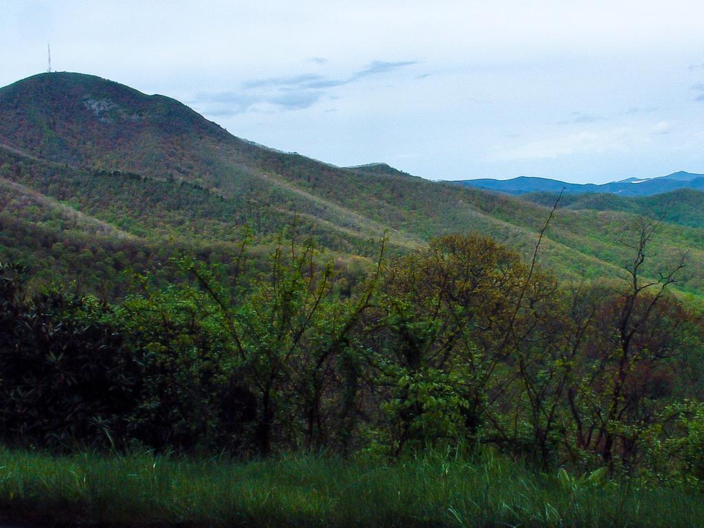
Mount Pisgah is a sharp, distinctive peak which lies along the mountain ridge south of Asheville, NC. The peak is clearly visible from most of Asheville and the French Broad River Valley and tops out at 5721 ft in elevation.

The Blue Ridge Parkway travels from Asheville past this famous mountain and the National Park Service's recreation area by the same name. Many other things in the area are also named after this mountain, including the Pisgah National Forest and the Pisgah Ranger District it lies within. This is one of the more popular recreation areas along the Blue Ridge Parkway.
History

Mount Pisgah itself is currently named after the biblical mountain from which Moses first saw the promised land. When the Cherokee were the land's only inhabitants, the mountain was named "Elseetoss" and what we now know as the Pisgah Ridge was named "Warwasseeta".
In 1776, expeditions were led into the mountains to fight against the Cherokee Indians. Accompanying the group was Presbyterian minister Rev. James Hall. According to one account of folk history, Hall was reminded of the Biblical story when enjoying the fabulous view from the summit, and named it Pisgah. Another story tells of a different Presbyterian minister, George Newton, who named it similarly in the early 19th century.
Whoever named it, the first recorded use of the name appeared in 1808 in a survey splitting Buncombe and Henderson Counties. The current county line crosses the peak of Pisgah. The now official name has been carried on to the National Forest which covers much of the region around Asheville, and the Pisgah District of this National Forest now surrounds the mountain. Several towns in the area carry the name of this mountain as well.
Most of these lands were eventually obtained as part of the original tract owned by George W. Vanderbilt, builder of the famous Biltmore Estate near Asheville. Vanderbilt also constructed the Buck Spring Lodge, just north of the current Pisgah Inn and below Mt. Pisgah's summit, which was to be his mountaintop retreat. He constructed the Shut-In Trail to climb the Pisgah Ridge to his lodge below the summit of Mt. Pisgah. This trail, still in use today, closely follows the current Blue Ridge Parkway. Later, much of the property Vanderbilt owned was eventually sold to the government to become the core of the Pisgah National Forest, but not before the first forestry school in the country was established near the Pink Beds area.
Vanderbilt needed to manage his vast holdings of forested lands. Therefore, he - along with his landscape architect, Fredrick Law Ulmstead - created the country's first school of forestry in the area now known as the Cradle of Forestry, accessible by the Buck Spring trail from the Pisgah Inn.
Hiking Trails in the Mount Pisgah Recreation Area

Hiking opportunities abound right out the door if you book a room at the Pisgah Inn, or right from your tent if you're staying at the campground!
The Buck Spring Trail starts south of Mount Pisgah near the Pink Beds area of the Pisgah National Forest, and gradually climbs up the Pisgah Ridge. As it nears the Pisgah Inn, it goes through the parking lot, and then heads north along the side of Little Bald Mountain toward the Mount Pisgah Parking Area and Mount Pisgah trailhead. Before reaching the parking area, it passes the historic Buck Spring Lodge site (see History above). The Mountains to Sea Trail shares this path up to the Mt. Pisgah Parking Area.
Aside from the short stroll to the old lodge site, good hikes on the Buck Spring Trail include out-and-back jaunts from US 276 North toward the Inn, and from the Inn either south or north (perhaps connecting to the Mount Mount Pisgah trail to reach the summit).
At the Mt. Pisgah Parking Area, the Shut-In Trail (see History above) heads north toward Asheville, closely following the Blue Ridge Parkway. The Mountains to Sea Trail also follows that route.
Also starting at the Mt. Pisgah Parking Area, the Mount Pisgah Trail leads (unsurprisingly) to the top of Mount Pisgah, where spectacular views can be found - back toward the Pisgah Inn, toward the Shining Rock Wilderness, to Cold Mountain, and north to Asheville and beyond to the Black Mountains. This historic, scenic trail is a must!
Connecting with the Buck Spring trail in between the Pisgah Inn and the Mount Pisgah Parking Area are the Laurel Mountain and Pilot Rock trails. A connector on the other side of Little Bald Mountain means a good, moderate loop hike can be made using these four trails, starting from either parking area. Beyond the connector, these difficult trails lead deep into the Pisgah National Forest's Mills River area.
Just a short distance south of the Pisgah Inn is Frying Pan Knob, an easier walk on a graveled road to a fire tower with a view of the Shining Rock Wilderness and the Pisgah National Forest. This is a good alternative for those who don't wish to attempt Mt. Pisgah itself.
Facilities in the Mount Pisgah Recreation Area
Lodging and camping are available. Dining (with a view) available at the Pisgah Inn Restaurant, where bag lunches can be purchased for day hikes. Drinks, snacks & camping supplies can be found at the camp/convenience store. Restrooms are available at the Pisgah Inn, the camp/convenience store, and at the Mount Pisgah Picnic Area
The Picnic Area is about halfway between the Pisgah Inn and the Mount Pisgah Parking Area. The picnic area has many tables on a level hill, with shaded and sunny sites available. Each has grills, and there is a large, grassy field for recreation.
