Big Butt Trail

At A Glance


5.6 mi one-way
Difficulty Rating: 5.6 ![]()
Steepness: Hilly ![]()
Tread Condition: Very Rough ![]()
Blaze Color: White
Trail Number: 161
Other Map ID: BRP MP 359.8
Description
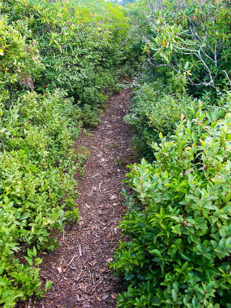
Yes, this really is the trail's name. Starts at the left side (facing away from the road) of the Walker Knob Overlook in Balsam Gap on the Blue Ridge Parkway, heading downhill. (The trail to the right, heading uphill, is the Mountains to Sea Trail). The trail has been well-maintained in recent years and is in fantastic shape, with lots of water management and well-placed log steps minimizing erosion as the trail has seen increased usage. It used to become quite overgrown in the summer, but overgrowth had been actively trimmed as of my last visit in July 2017.
The trail descends beside the Parkway, then angles north and continues onto Pisgah National Forest/Appalachian Ranger District property. It begins a gradual climb up Brush Fence Ridge, which is the western ridge of the Black Mountains.
The trail passes through a high-elevation forest with lots of Red Spruce and Sweet Birch, a few Fraser Fir, and other northern hardwoods. Some of the Red Spruce along the ridge are enormous.
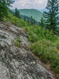
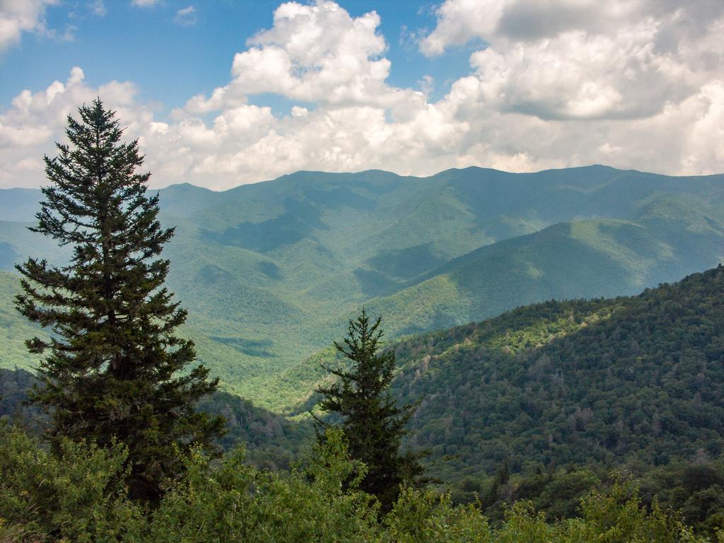
The trail crosses a low-prominence unnamed summit and then climbs gently to Point Misery at 5715 ft. Past Point Misery, the trail descends somewhat more steeply through a set of switchbacks and more big Red Spruce. It bottoms out in a gap at about 5330 ft. and begins climbing again toward Little Butt mountain in an area with hawthorn trees. From Little Butt the trail follows the narrow ridge leading to Big Butt, which drops off steeply on both sides, where there are at times excellent views of the Cane River Valley, the eastern Black Mountains and Mount Mitchell - an exhilarating vista.
The trail then skirts the east side of Big Butt before crossing Flat Spring Knob and a few smaller, unnamed summits on the ridge to its north. Where Wilson Ridge angles northeast, the trail angles northwest toward Cane River Gap, descending steeply through switchbacks. The northern terminus of this trail is on NC 197.
Intersecting Trails
This trail is located in the Blue Ridge Parkway Section 4 area. For a list of all the trails in that area, see the Blue Ridge Parkway Section 4 trails list page.
This trail also crosses into these trailhead areas:
All Photos from the Trail


GPS Map
Map Information
Download GPS Data
Click on a route, trail, or point on the map and select the GPS Data tab to download its data.
Data Formats
KML (Google Earth)
KML is the main file type used by Google Earth. If you have Google Earth installed, clicking the KML link should open the trail or point directly in Google Earth for viewing. This is the native file format used by Google Earth, but many other map applications can use and understand KML as well, so if you're not sure which one to download, KML is a good bet.
GPX
The GPX format stands for GPS Exchange - a free, open, XML format for exchanging GPS and map data. GPX is compatible with Google Earth, many other mapping programs, and most GPS devices (such as Garmin). Load the file directly into your GPS to help find your way on your next trip!
GeoJSON
GeoJSON is a newer, lightweight data exchange format which can be used to quickly share map data and may have a smaller size than KML or GPX. Many professional mapping and GIS applications support the GeoJSON format.
About the Map
Copyright
Base Layers
Base layers provided by OpenStreetMap, the US Geological Survey, the US Forest Service, and NC OneMap. Base layer images are subject to the respective copyright policies of their owners. Base layers may not be available at all times due to system maintenance or outages.
WNCOutdoors Base Layer
The WNCOutdoors Base layer is provided by WNCOutdoors.info. It is licensed by Creative Commons Attribution 3.0.
Trail and Marker Overlays
Trail layers and downloadable data are all original works created by WNCOutdoors with guidance from a variety of sources, including ensembles of our own GPS tracks, user contributed GPS tracks, official maps and GIS data from government agencies, and field observations. WNCOutdoors data is made freely available under the Open Database License - you are free to copy and use it for any purpose under the terms of that license (summary).
Tips
- Hover over a trail to see it highlighted. Helps to see start and end points for an individual trail.
- Scroll and zoom the map before printing, and that view will persist into the printed image.
- Click a trail for more details and to download it individually.
Feedback
Ratings
Average Rating: 4.3 (rated 3 times)
Rate It Now:

Bob said: I hiked this trail 6/13/17. Very difficult but the views are amazing. Beware that about half the trail (3 miles) is overgrown with knee high grasses.
Susie said: Hiked this trail today from BRP to Little Butt. Up and down but very well maintained with steps in all the steep parts. Beautiful views of Mt Mitchell and the Blacks. Wildflowers still plentiful. Only saw one other hiker. I think it is rated too harshly!