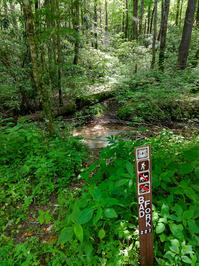
Bad Fork Trail

At A Glance


2.5 mi one-way
Difficulty Rating: 5.13 ![]()
Steepness: Climbs Steeply ![]()
Tread Condition: Moderately Rough ![]()
Lowest Elevation: 1780 ft
Highest Elevation: 3005 ft
Climb Total: 1225 ft
Trail Number: 227
Description
Bad fork. BAD!
But seriously, though this trail promises to be a potential loop when combined with the Armstrong Creek and Woods Mountain/Mountains to Sea trails, this one is covered with dead rhododendron downfall and is extremely difficult to follow (as of reports from 2014 and more from 2020). User discretion is advised.
This trail is located in the Grandfather Ranger District area. For a list of all the trails in that area, see the Grandfather Ranger District trails list page.
All Photos from the Trail

Feedback
Ratings
Average Rating: 3.0 (rated 6 times)
Rate It Now:

No comments yet.