This trail steadily climbs through upland hardwood forests and rhododendron thickets. After the initial ascent, the trail mostly follows ridge tops offering views of Big Creek drainage. The best viewing times are early spring, late fall and winter....
This trail begins at the gate on FS 3509 and follows gravel road for one mile. At this point, the trail leaves the gravel road and follows an old wooded road into a cove. The path then steadily climbs Green Ridge and crosses Dry Creek headwaters. The...
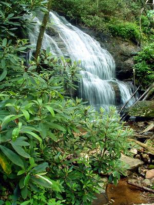
The Hickey Fork trail travels through the Shelton Laurel Backcountry Area. It should be treated as such; only those experienced in wilderness travel should attempt to hike all of it. More casual hikers will enjoy an out-and-back trip to the falls on...
Formerly known as the Whiteoak Flats trail. The trail leaves FS 111 from parking on the road’s left side. The trail is especially scenic in late spring when the rhododendron and mountain laurel are in bloom.
Crossing Big Creek and climbing a...
This trail offers a walk through upland hardwood forests with winter views of Baxter Cliffs. The trail provides loop opportunities with the Hickey Fork trail.
2.3mi, Climbs Steeply, Some Obstacles
Nearby Trails
The following trails cross into this trailhead area, but are primarily accessed from another trailhead: