Chestnut Knob Trail

At A Glance


2.1 mi one-way
Difficulty Rating: 2.1 ![]()
Steepness: Climbs Moderately ![]()
Tread Condition: Moderately Rough ![]()
Blaze Color: White Diamond
Other Map ID: 2
Description
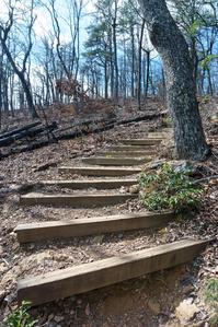
Starts off of High Shoals Falls Loop Trail, 0.2 mi from the Jacob Fork parking area. This trail was rebuilt after the devastating Chestnut Knob wildfire of November 2016; it is well-constructed and easy to follow. The trail ascends on a moderately steep route through switchbacks and stair steps one mile to a cleared view of High Shoals Falls. Along the way, it passes a neat rock outcrop and boulder field area above a steep ravine.
The forest along the entire route was burned during the fire; evidence of it is everywhere including charred stumps and fallen logs, stump holes, standing dead trees and a clear/dead understory layer. The mixed pine-oak forest still has many surviving trees, though, and the laurels readily re-sprout from the still-living roots and will begin filling in again over the years, slowly erasing the fire's scars. Wildflowers and young trees, whose seeds easily escaped the flames down in the duff layer, take advantage of the increased sunlight and sprout prolifically in spring.
The grade moderates considerably as you approach the view. The view area is partially burned debris/partially cleared dead trees so the foreground is kind of ugly. However, the view is fantastic and this will improve with time.
The trail continues another mile up to Chestnut Knob. The trail winds into a small side cove, wraps around a wet-weather branch and spring and then climbs up atop the low ridge, which it follows the remainder of the way to the summit just south of Chestnut Knob, with one steeper section just before the high point. The true summit is just to the right (north) but there is not much to see there; turn left (south) to reach the overlook in 0.2 mi.
The trail descends some rock steps to reach the overlook. This outcropping offers a beautiful view of the Jacob Fork Gorge and the South Mountains range. Though the trees surrounding the overlook are nearly all dead due to the wildfire, the view will improve once they weaken and fall and a veritable carpet of seedlings is coming up to take their place. Use extreme caution here; this is a jagged crag of rock with bluffs on all sides.
This trail is located in the South Mountains State Park area. For a list of all the trails in that area, see the South Mountains State Park trails list page.
All Photos from the Trail


Feedback
Ratings
Average Rating: 4.3 (rated 3 times)
Rate It Now:

Tony said: Definitely not level. The first 0.5 miles climbs quite a bit over a series of switchbacks. The next mile or so is level to rolling terrain then it steepens again just before the grand finale' overlook. It was a very enjoyable hike, and I hope to do it again soon.
Chuck said: I help build this trail back in the mid ninetys ...loved it then love it now.
Tony Lail said: this is a more moderately difficult trail.....most of this trail you are constantly climbing.....nothing too serious, but not level or easy.....