High Shoals Falls Loop Trail

At A Glance


2.7 mi one-way
Difficulty Rating: 2.7 ![]()
Steepness: Climbs Steeply ![]()
Tread Condition: Moderately Rough ![]()
Blaze Color: Blue Circle
Other Map ID: 7
Description
This short, but steep, and very popular trail takes hikers about a mile to High Shoals Falls. All junctions are signed and the tail is well blazed.
Starts at the Jacob Fork parking area on an old road to the right of the picnic area. (You can also take the Hemlock Nature trail which parallels this trail but closer to the river for a short distance). Past the junctions with Chestnut Knob and Hemlock Nature trail, this trail crosses Shinny Creek on a bridge. Junction with the H.Q. trail is past the bridge on the right; continue straight. The trail enters a small clearing where it splits to make the loop portion of the hike. The quickest way to the falls is to take a left here and do the loop clockwise.
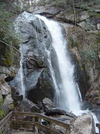
This path, which is now a purpose-built trail, follows the beautiful Jacob Fork river upstream to the falls beside huge boulders, large trees, and deep, clear pools. Climbs along this part of the trail are moderately steep. The surface is quite rocky on this stretch with many bridge and staircase structures along the way. Before the final ascent to the falls, the trail crosses the river once at a beautiful area stacked high with huge boulders and small cascades all around them.
A side path to the right leads across a bridge to a viewing area near the middle of the falls atop a huge boulder.
The trail continues to climb beside the falls up a very steep set of steps. It crosses the river above the falls on another bridge and then starts heading northeast across a low ridge. Keep right at the two Upper Falls trail junctions. It then heads back downhill on a moderately steep path through nice but nondescript forest areas to the loop split.
Turn left to head back to the parking area.
This trail is located in the South Mountains State Park area. For a list of all the trails in that area, see the South Mountains State Park trails list page.
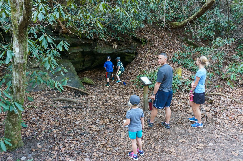
All Photos from the Trail


GPS Map
Map Information
Download GPS Data
Click on a route, trail, or point on the map and select the GPS Data tab to download its data.
Data Formats
KML (Google Earth)
KML is the main file type used by Google Earth. If you have Google Earth installed, clicking the KML link should open the trail or point directly in Google Earth for viewing. This is the native file format used by Google Earth, but many other map applications can use and understand KML as well, so if you're not sure which one to download, KML is a good bet.
GPX
The GPX format stands for GPS Exchange - a free, open, XML format for exchanging GPS and map data. GPX is compatible with Google Earth, many other mapping programs, and most GPS devices (such as Garmin). Load the file directly into your GPS to help find your way on your next trip!
GeoJSON
GeoJSON is a newer, lightweight data exchange format which can be used to quickly share map data and may have a smaller size than KML or GPX. Many professional mapping and GIS applications support the GeoJSON format.
About the Map
Copyright
Base Layers
Base layers provided by OpenStreetMap, the US Geological Survey, the US Forest Service, and NC OneMap. Base layer images are subject to the respective copyright policies of their owners. Base layers may not be available at all times due to system maintenance or outages.
WNCOutdoors Base Layer
The WNCOutdoors Base layer is provided by WNCOutdoors.info. It is licensed by Creative Commons Attribution 3.0.
Trail and Marker Overlays
Trail layers and downloadable data are all original works created by WNCOutdoors with guidance from a variety of sources, including ensembles of our own GPS tracks, user contributed GPS tracks, official maps and GIS data from government agencies, and field observations. WNCOutdoors data is made freely available under the Open Database License - you are free to copy and use it for any purpose under the terms of that license (summary).
Tips
- Hover over a trail to see it highlighted. Helps to see start and end points for an individual trail.
- Scroll and zoom the map before printing, and that view will persist into the printed image.
- Click a trail for more details and to download it individually.
Trail Segments
Trails are often made up of several connecting paths which may have different characteristics, allowed uses, and seasons. This trail is divided into multiple segments as follows:
High Shoals Falls Loop - Picnic Area to Trail
- Allowed Uses: Hiking
- Length: 0.44 mi
High Shoals Falls Loop - Trail to Falls
- Allowed Uses: Hiking
- Length: 0.41 mi
High Shoals Falls Loop - Falls to Top
- Allowed Uses: Hiking
- Length: 0.21 mi
High Shoals Falls Loop - Road Portion
- Allowed Uses: Hiking
- Length: 0.52 mi
High Shoals Falls Loop - Upper Falls Tr.
- Allowed Uses: Hiking
- Length: 0.34 mi
Total Calculated Length: 1.91 mi
This value is derived from our underlying map data, and it may not match officially published information.
Feedback
Ratings
Average Rating: 3.5 (rated 6 times)
Rate It Now:

Chris said: It looks like the segment mileage estimates are about a half mile off from the total length of the trail for a full loop: High Shoals Falls Loop - Picnic Area to Trail (out) = 0.4 High Shoals Falls Loop - Trail to Falls = 0.4 High Shoals Falls Loop - Falls to Top = 0.2 High Shoals Falls Loop - Road Portion = 0.5 High Shoals Falls Loop - Upper Falls Tr. = 0.3 High Shoals Falls Loop - Picnic Area to Trail (back) = 0.4 Total = 2.2 miles Any idea why? Also, when I download the GPS tracks, I'm only getting the upper portion of the loop.
@carolinatrekker said: Hiked this trail in December 2015 with my wife and children (4 yrs and 12 yrs old). They loved it. There are all kinds of interesting things to see on this short trail: boulders, a nice stream, cascades, a beautiful waterfall, and all the stairs and bridges. Kept things interesting. I'd only recommend the 2nd half for those who aren't afraid of stairs, heights, or lots of climbing. A great trail! Pics and fuller hike info here: http://www.facebook.com/media/set/?set=a.702165616585390.1073741838.557584497710170&type=1&l=d08dcd4abc
Chip O said: Went both routes with full packs great for a starter backpacker. Upper falls campground is blissful even other campers plenty of open space. gather fire wood as you hike in.
Herbie Pearthree said: Beautiful hike that provides a great up close view of the falls. Wonderful for a day hike. If you're over-nighting you may want to pick another route if you have a backpack on - the stairs along the falls are a serious workout and should only be attempted by those that are in very good physical and cardio shape if also carrying an overnight backpack.
mbd said: Where's the map?