Skinny Dip Falls Hike
This moderate, short hike takes you to an appealing waterfall and swimming hole on the Yellowstone Prong of the Big East Fork of the Pigeon River. It makes a great summer swimming destination, a great way to stretch your legs if you're traveling the parkway, and a great place for photographers - both for the falls and forest scenes and wildflowers on the way down. If you're feeling hoppy, this would make the start of a more strenuous trek into Graveyard Fields.
At A Glance
 0.8 mi round-trip
Difficulty Rating: 1.31 ![]()
Tread Condition: Moderately Rough ![]()
Climb: Climbs Moderately ![]()
Lowest Elevation: 4320 ft
Highest Elevation: 4504 ft
Climb Total: 210 ft
Configuration: Out-and-back
Starting Point: Mile marker 417 on the Blue Ridge Parkway, at the Looking Glass Rock overlook
Trails Used: Mountains to Sea Section 2
Hike Start Location
Directions
From Asheville, take the Blue Ridge Parkway south past Mount Pisgah and US 276 to MP 417. Park at the Looking Glass Rock overlook, which is on the left.
Details
Hike Description
To begin the hike, cross the parkway and head up the path right beside the Mile Marker 417 post. The path goes slightly uphill, into a cool forest of birches and hemlocks, oaks and maples. You'll come to an open spot and climb a small set of steps, then reach an intersection. The Mountains to Sea Trail comes in from the right and continues straight. Go straight, across an old roadbed. This trail then continues all the way to the falls, and after the steps it's downhill the whole way.
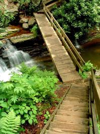
The trail is moderate, with a few rough spots - rocks, roots, wet areas, or eroded spots. It's nothing terribly difficult, and most anyone should be able to make the trek. You'll descend into the valley as you go, with the sound of the Yellowstone Prong ever-increasing. There are a few small log and plank bridges, and some steps at a point just before you reach the falls.
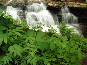
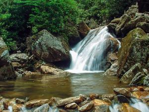
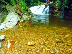
The trail descends a steep set of steps which land on a bridge across the Yellowstone Prong. The area is immediately appealing - the lower deep, clear pool is directly below the bridge. The falls consists of three tiers - and the bottom tier drops directly into the deep pool. There are two more pools between each tier of the falls upstream. The height of the falls is only about 30' total, each tier being between about 10 - 15' high. But the overall scenery and appeal of the deep pools makes up for the lack of an impressive cataract.
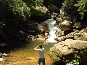
If you do come during the warmer months, feel free to swim, but despite the name of the falls make sure you bring a bathing suit and a towel/change of clothes - you will get cold! If you don't swim, there are plenty of small beaches and flat rocks to explore or just sit on.
If you continue up the trail past the bridge, the trail continues up to Graveyard Fields and eventually ends in the Great Smoky Mountains National Park. To return to your vehicle, backtrack on the same trail.
Conntecting Trails: If you continue past Skinny Dip Falls on the Mountains to Sea trail on a steep, uphill climb, you can reach Graveyard Fields. Thus, it's possible to reach the falls from the Graveyard Fields area and vice versa.
All Photos from This Hike
Map
Green highlight indicates the route to follow within the trail network for this hike.
Tip: Printing this map? You can pan and zoom the map as desired before printing to show the area you need.
Map Information
Download GPS Data
Click on a route, trail, or point on the map and select the GPS Data tab to download its data.
Data Formats
KML (Google Earth)
KML is the main file type used by Google Earth. If you have Google Earth installed, clicking the KML link should open the trail or point directly in Google Earth for viewing. This is the native file format used by Google Earth, but many other map applications can use and understand KML as well, so if you're not sure which one to download, KML is a good bet.
GPX
The GPX format stands for GPS Exchange - a free, open, XML format for exchanging GPS and map data. GPX is compatible with Google Earth, many other mapping programs, and most GPS devices (such as Garmin). Load the file directly into your GPS to help find your way on your next trip!
GeoJSON
GeoJSON is a newer, lightweight data exchange format which can be used to quickly share map data and may have a smaller size than KML or GPX. Many professional mapping and GIS applications support the GeoJSON format.
About the Map
Copyright
Base Layers
Base layers provided by OpenStreetMap, the US Geological Survey, the US Forest Service, and NC OneMap. Base layer images are subject to the respective copyright policies of their owners. Base layers may not be available at all times due to system maintenance or outages.
WNCOutdoors Base Layer
The WNCOutdoors Base layer is provided by WNCOutdoors.info. It is licensed by Creative Commons Attribution 3.0.
Trail and Marker Overlays
Trail layers and downloadable data are all original works created by WNCOutdoors with guidance from a variety of sources, including ensembles of our own GPS tracks, user contributed GPS tracks, official maps and GIS data from government agencies, and field observations. WNCOutdoors data is made freely available under the Open Database License - you are free to copy and use it for any purpose under the terms of that license (summary).
Tips
- Hover over a trail to see it highlighted. Helps to see start and end points for an individual trail.
- Scroll and zoom the map before printing, and that view will persist into the printed image.
- Click a trail for more details and to download it individually.
Feedback
Ratings
Average Rating: 3.5 (rated 24 times)
Rate It Now:




Cindy said: Perfect description. This hike is short but a little hard and so worth it. The falls and natural pool areas are stunning. As usual fellow hikers are always polite and share the trail as well. Been twice and will go again!
nelly said: Does it cost anything ?
Eric said: https://www.youtube.com/watch?v=BANgmQdN1T0
Libbie said: Thank you for your informative information regarding the falls, I plan to visit this fall this summer 2013. We are from TN and my new hubby is to visit and see as many Falls possible, ive seen several very large falls and several small falls.. The small falls are just as beautiful sometimes the scenery on the hike down is just as beautiful as the fall its self..If you know of any other beautiful Waterfalls pls be so kind to email me back at libbridges69@gmail.com. Thank you and have a blessed day, Libbie "TN Gal Searching for Mother Natures Beauty"!