Firescald Knob Hike

Comprising one of the easier destination hikes in North Carolina's Shelton Laurel area of Pisgah National Forest (and winding into Tennessee's Cherokee National Forest as well), a portion of the Appalachian Trail near Camp Creek Bald invites day hikers in addition to the thru-hikers who arrive here in Spring. The views from the colorfully-named peaks nearly 5000 ft in elevation (like Firescald Knob) on this section of the A.T. are simply fantastic. This elongated loop courses along the state line ridge, passing through enchanted forests, open meadows, and rocky, exposed summits.
At A Glance
 4.5 mi round-trip
Difficulty Rating: 6.46 ![]()
Tread Condition: Moderately Rough ![]()
Climb: Hilly ![]()
Lowest Elevation: 4180 ft
Highest Elevation: 4540 ft
Climb Total: 700 ft
Configuration: Loop with out-and-back portions
Starting Point: Parking area on Little Firescald Knob
Trails Used: Appalachian Trail - NC 208 to NC 212
Hike Start Location
Directions
From the junction of US 25/70 and NC 208 east of Hot Springs, NC, take NC Hwy. 208 for 3.5 miles to the junction with NC Hwy. 212. Turn left; you'll reach the Tennessee state line in 5.8 miles. The road turns to TN 70. Continue 0.3 miles, and then turn right onto Viking Mountain Road. The road is paved for about 5 miles and then turns to gravel, and the name changes to Bald Mountain Road as it winds its way up the mountain. You'll reach a junction at Jones Meadow about 8 bumpy miles from TN 70; turn left. (To the right are the towers on Camp Creek Bald). A short stretch of pavement ends atop Little Firescald Knob at a parking area. Park there.
Details
Hike Description

In the 1960's, construction began at an old strip mine below Camp Creek Bald. Investors hoped to turn the open areas into a ski resort which was to be called Viking Mountain. A ski lodge, restaurant, swimming pool, and several homes were built, but the development eventually failed. The land was bought by the US Forest Service and the clearings and old road beds are all that remains of the development today after the last structures were removed by the 90's. Many believe the bad road leading to the resort led to its eventual failure.
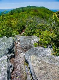
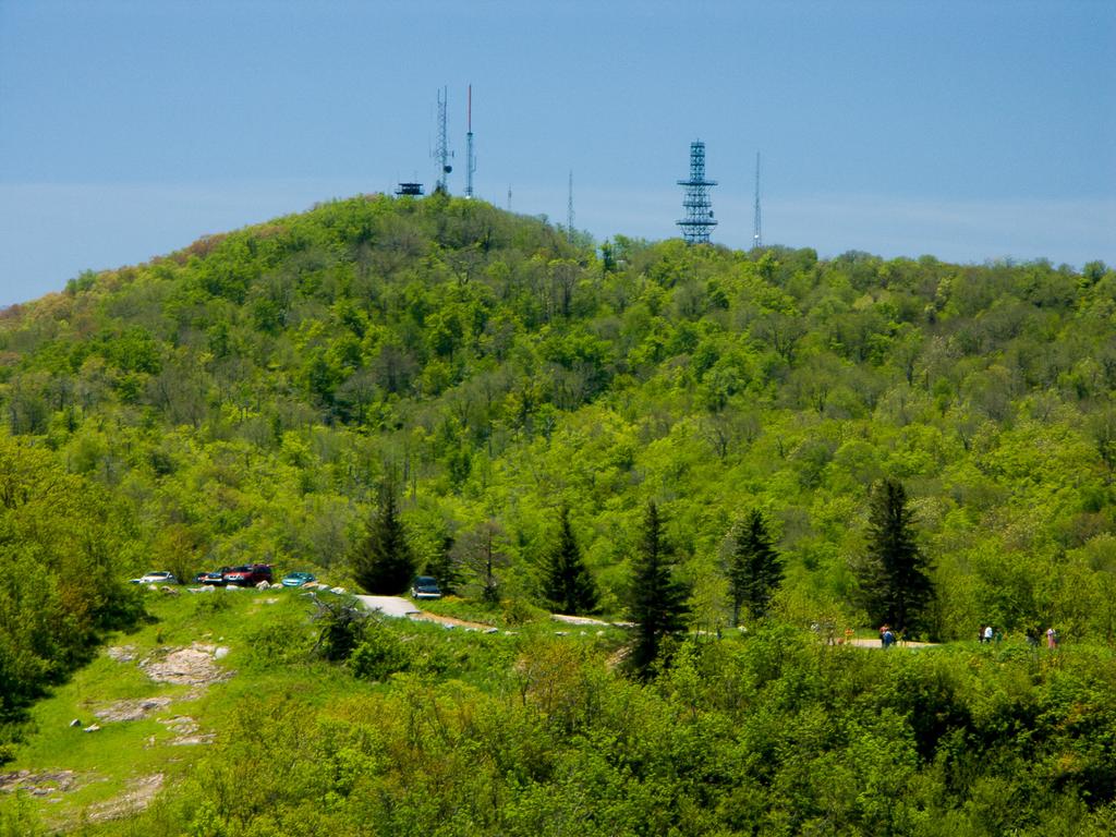
The parking area is the location of the old ski lodge. Looking northeast from the parking area on Little Firescald Knob, away from the communications towers on Camp Creek Bald, you'll see the cleared area continuing downhill to a gap. Behind that, there's a great view of Blackstack Cliffs, which is your first destination on this hike.
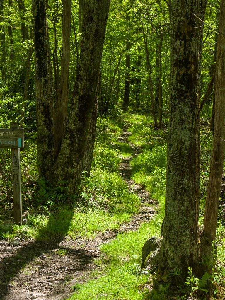
Start the hike by heading north down into the gap. You can either just go straight down the ridge through the clearing, or turn around and take the blue-blazed old road just south of the parking area on the left. Both end up in the gap.
From the gap, two old roads continue north. One is blue-blazed and goes uphill around a large mud puddle; take this one. This road looks like it may still be illegally used from time to time by four-wheel drive vehicles that can make it through the huge mire. After a short climb, the road levels out and enters another junction area; two blue-blazed trails or old roads head straight and to the right from here. Take either one; they both lead a few hundred feet to the white-blazed Appalachian Trail (A.T.) about 1/4 mile from the parking area. Turn left on the A.T. to continue the hike.
The A.T. goes on a nearly level course through a northern hardwood forest a short distance east of the summit ridge. It's rocky, with some deep mud pits in places. In about 300 ft, another blue-blazed side trail heads left, uphill, signed "Blackstack Cliffs". Take this path another 300 ft to reach a small network of manways which lead out onto the rocks atop the cliffs.

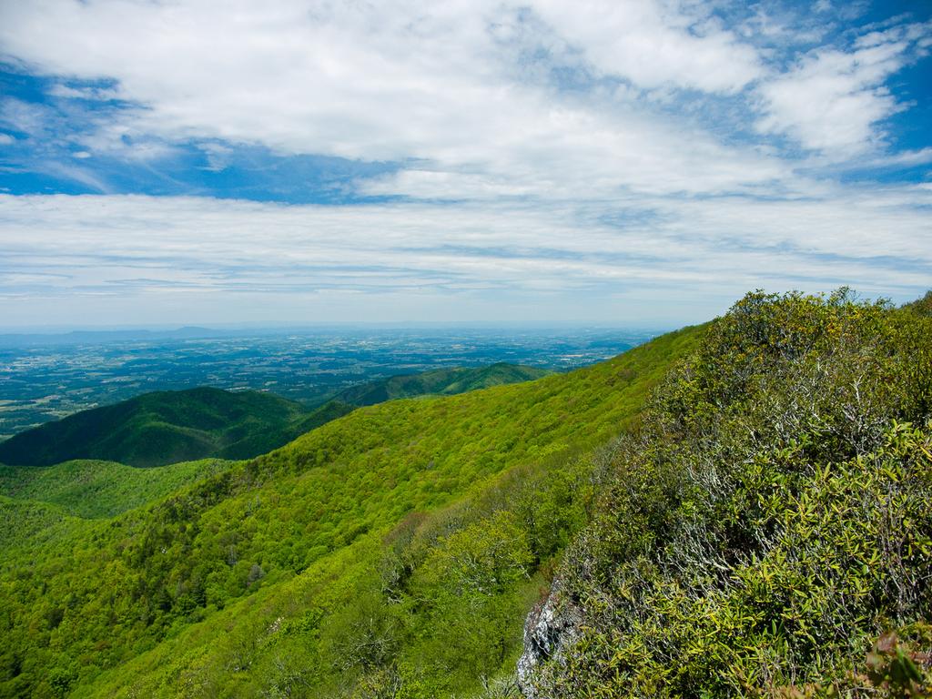
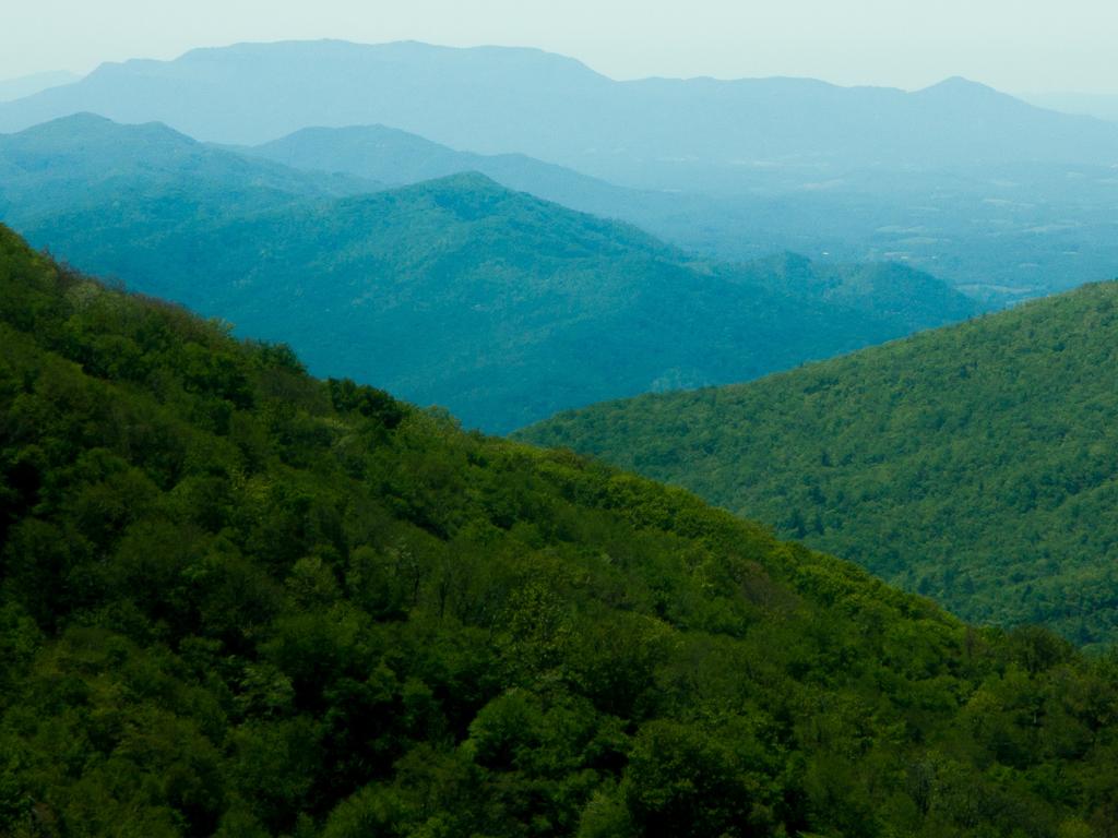
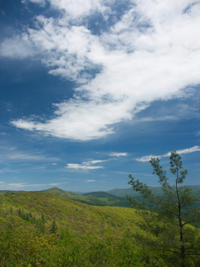
It goes without saying to be careful here, as there are some steep drop-offs in places. But the view is fantastic. Looking back to the south, you can see the parking area at Little Firescald Knob, with Camp Creek Bald and its towers looming behind. To the southwest, around the shoulder of Camp Creek Bald, you can catch a glimpse of the Great Smoky Mountains. And to the northwest you see the relatively-level Tennessee Valley and the town of Greeneville, TN. On a very clear day, you can see the long, straight ridges rising above I-81 on the other side of the valley.

Return to the A.T. and turn left, continuing north, on a very muddy stretch of trail. The trail descends slightly less than 0.2 mi to 4400 ft Bearwallow Gap, and reaches a junction on the right with the Jerry Miller trail (which eventually descends to Whiteoak Flats and Big Creek in the Shelton Laurel area). Continue straight on the A.T.; in about 130 ft the A.T. splits at a sign marked "Exposed Ridgeline Trail" (right, white-blazed) and "Bad Weather Trail" (left, blue-blazed). Unless you're thru-hiking the A.T. and have no choice, you're probably not going to be up here on a bad-weather day, so take the right fork and begin a gentle ascent up the ridge toward the views you came for.

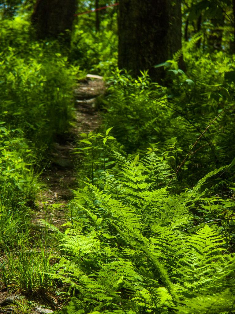
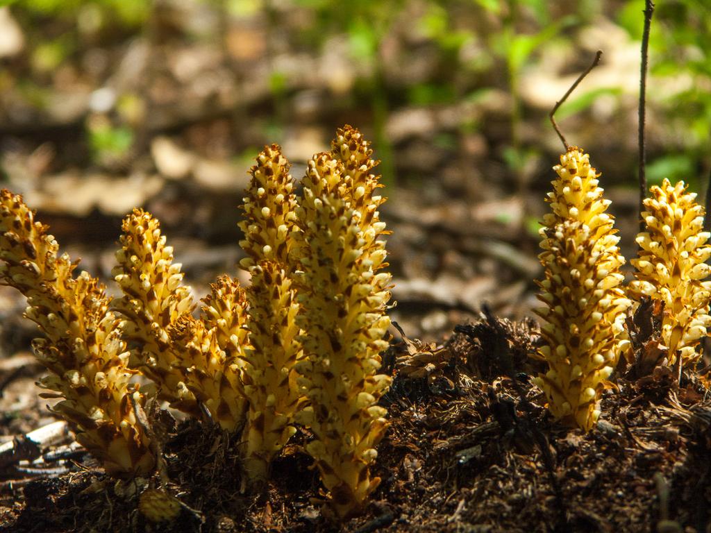
Before you come out atop the ridge, the trail winds around rock features and up across steps and stones. It's up and down, steep in places, but only a moderate overall elevation gain. This trend will continue all the way along the ridge. Ferns grow underneath rhododendron, which grows underneath a northern hardwood overstory consisting of quite a few birch, beech, and maple trees. Despite being exposed on the ridgeline, the forest has a rather lush feel to it and makes for a very pleasant walk.
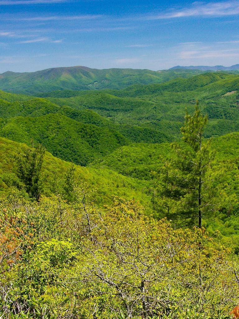
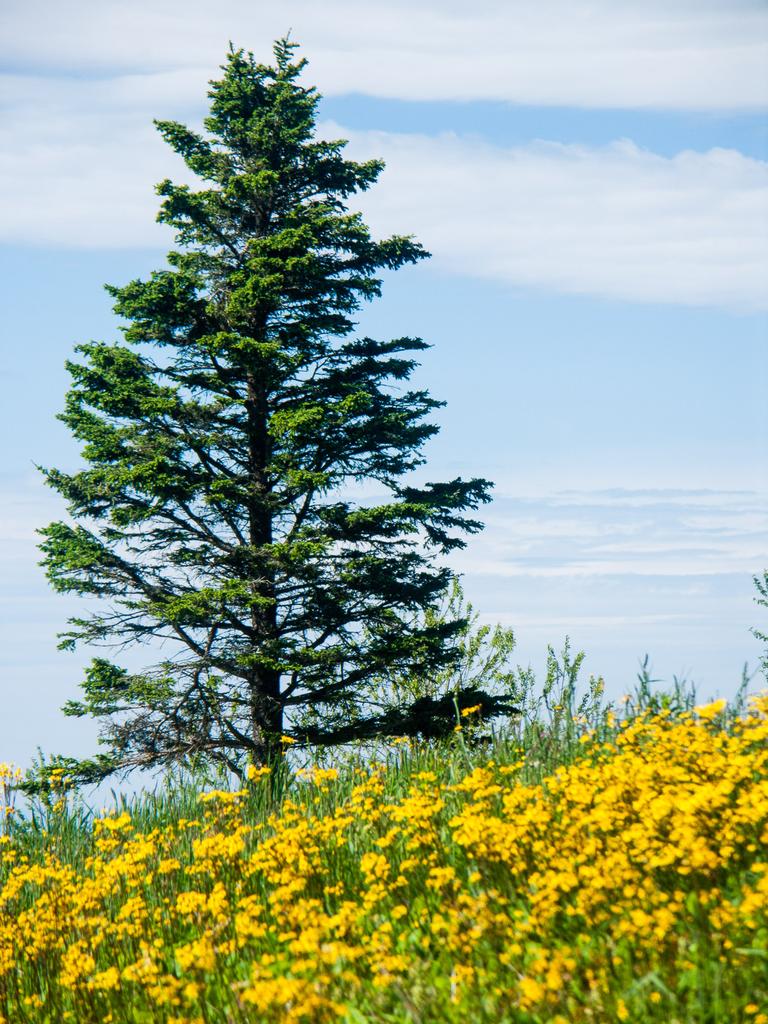
In about s half mile, the trail approaches the summit of the ridge, and climbs to its crest - out of the trees and into the shrubbery of rhododendrons and blueberries at Big Firescald Knob. More cliffs lie to the northwest, while exposed rock slopes drop away more gently to the southeast, but you can get 360-degree views from up here in all seasons above the shrubbery. The views continue like this along the next half-mile or so stretch of trail.
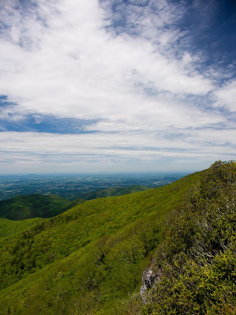
You get some better views into North Carolina now. Directly downslope on the NC side lies the Shelton Laurel Backcountry area. Mountains to the south are layered in a seemingly endless fashion, while to the east, the mass of the Black Mountain range - topping 6500 ft in elevation - dominates the horizon.
To the northeast rises a continuation of the Bald Mountains (of which Big Firescald Knob and Camp Creek Bald are a part), with Big Bald marking their highest point at 5500 ft. Much less human development is evident on the NC side of the ridge, but you can see part of the Wolf Laurel/Wolf Ridge ski resort to the south of Big Bald on a clear day.

The trail crosses white rock outcrops which shine in the sun. Segments of the trail are anchored with thick steel rebar while massive stone steps comprise other parts of it, attesting to the difficulty in constructing this beautiful segment of trail. It was completed in 2003 as a more scenic alternative to the old trail farther down slope, which you will use later as your return path. It's now one of the scenic highlights of the A.T. between Max Patch Mountain and Big Bald farther north.
The trail stays at a consistent elevation of about 4500 ft along the summit of Big Firescald Knob's ridge. However, don't let the seemingly level ridge fool you: the trail goes up and down small outcrops and piles of rocks, and some of the rock sections are steep - scrambles more than traditional trail - so it will be somewhat more taxing than a regular mile. Take your time, take pictures, enjoy the view, and maybe have a lunch somewhere along the way.
The trail finally begins a more earnest descent after passing the top of Chimneyrock Ridge. You'll come back to the northern intersection with the "Bad Weather" trail about 0.4 mi past the start of the descent, in a relatively level area at about the 4200 ft elevation mark. This is the farthest-out portion of this hike.

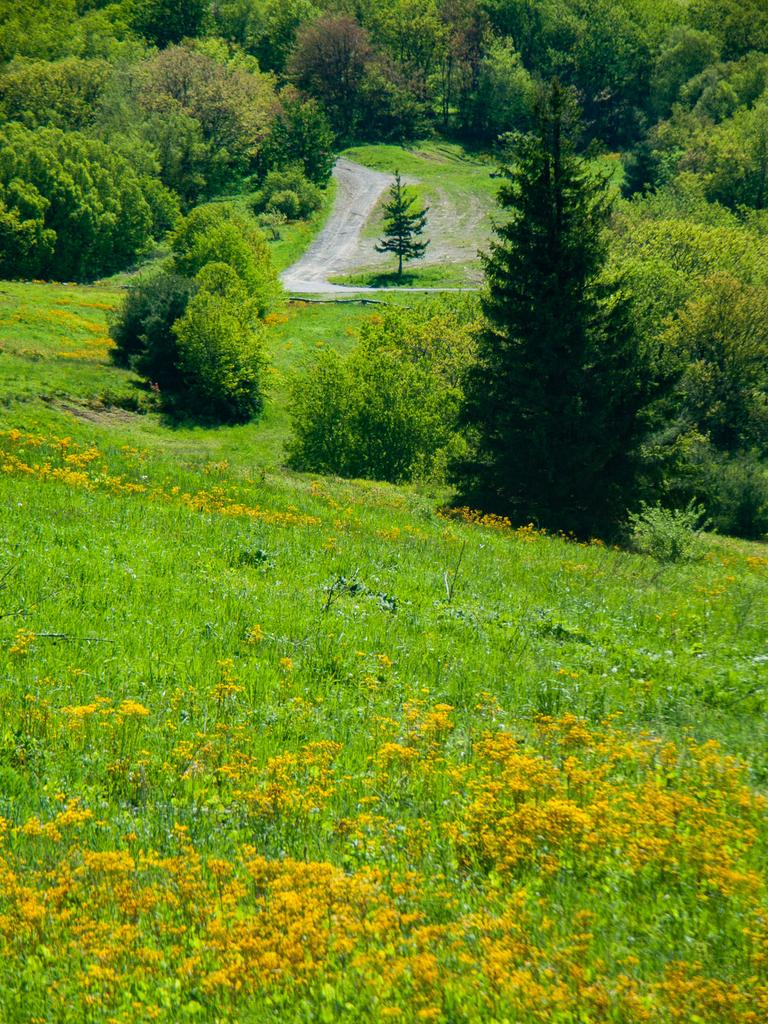
Turn left to continue around the loop portion of the hike. Now that the rough trail and climbing is mostly behind you, you can again enjoy the open woods which, near the beginning, seem to have been affected by a wildfire a few years back. The trail passes through beds of ferns and lush forest, which replace the views on this leg of the hike.

The grade is a gentle climb now, gaining only about 200 ft over the 1.4 mi back to Bearwallow Gap, and though it is rocky in a few places it's quite a bit easier to maneuver than the exposed ridgeline route. You may find the headwaters of some streams or springs coming down off the ridge, but they'll be tiny this high up and present no danger of wet feet. (If the weather is dry, you probably won't even see water - so don't count on it).
The trail curves back around to Bearwallow Gap and reaches the first junction with the Exposed Ridgeline trail again to finish the loop part of the hike. Turn right back onto the muddy section to climb back toward Little Firescald Knob and complete the hike. You'll need to bear right onto the blue-blazed old road bed this time and follow it back to the meadows and parking area.
All Photos from This Hike


Map
Green highlight indicates the route to follow within the trail network for this hike.
Tip: Printing this map? You can pan and zoom the map as desired before printing to show the area you need.
Map Information
Download GPS Data
Click on a route, trail, or point on the map and select the GPS Data tab to download its data.
Data Formats
KML (Google Earth)
KML is the main file type used by Google Earth. If you have Google Earth installed, clicking the KML link should open the trail or point directly in Google Earth for viewing. This is the native file format used by Google Earth, but many other map applications can use and understand KML as well, so if you're not sure which one to download, KML is a good bet.
GPX
The GPX format stands for GPS Exchange - a free, open, XML format for exchanging GPS and map data. GPX is compatible with Google Earth, many other mapping programs, and most GPS devices (such as Garmin). Load the file directly into your GPS to help find your way on your next trip!
GeoJSON
GeoJSON is a newer, lightweight data exchange format which can be used to quickly share map data and may have a smaller size than KML or GPX. Many professional mapping and GIS applications support the GeoJSON format.
About the Map
Copyright
Base Layers
Base layers provided by OpenStreetMap, the US Geological Survey, the US Forest Service, and NC OneMap. Base layer images are subject to the respective copyright policies of their owners. Base layers may not be available at all times due to system maintenance or outages.
WNCOutdoors Base Layer
The WNCOutdoors Base layer is provided by WNCOutdoors.info. It is licensed by Creative Commons Attribution 3.0.
Trail and Marker Overlays
Trail layers and downloadable data are all original works created by WNCOutdoors with guidance from a variety of sources, including ensembles of our own GPS tracks, user contributed GPS tracks, official maps and GIS data from government agencies, and field observations. WNCOutdoors data is made freely available under the Open Database License - you are free to copy and use it for any purpose under the terms of that license (summary).
Tips
- Hover over a trail to see it highlighted. Helps to see start and end points for an individual trail.
- Scroll and zoom the map before printing, and that view will persist into the printed image.
- Click a trail for more details and to download it individually.
Feedback
Ratings
Average Rating: 4.7 (rated 3 times)
Rate It Now:

No comments yet.