Trails in the Blue Ridge Parkway Section 1 Trailhead Area

Here is a list of all trails in the Blue Ridge Parkway Section 1 Trailhead area.

Each trail has its own printable page with all the information and links, including (where available):

  • directions to the starting point
  • difficulty
  • length
  • elevation change
  • a map
  • photos from along the way, and
  • a detailed description and trail directions.

For general information about the Blue Ridge Parkway Section 1 trailhead, see the Blue Ridge Parkway Section 1 Trailhead page.

Need to find trails by another method? Go back to Trails.

Basin Creek Trail

Moderate
  • 3.3mi, ,

Bluff Mountain Trail

Moderate
  • 7.5mi, ,

Bluff Ridge Trail

  • 2.9mi, ,

Cedar Ridge Trail

Moderate
  • 4.2mi, ,

Cumberland Knob Trail

Easy
  • 3mi, Climbs Gently, Moderately Rough

Flat Rock Ridge Trail

Moderate
  • 5mi, ,

Fodder Stack Trail

Moderate
  • Travels through a mixed pine/hardwood forest.
  • 1mi, ,

Fox Hunters Paradise Trail

Easy
  • 0.2mi, ,

Grassy Gap Road Trail

Moderate
  • 6.5mi, ,

Gully Creek Trail

Moderate
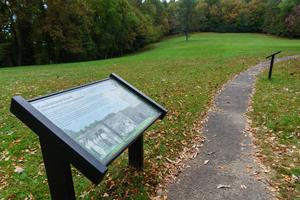
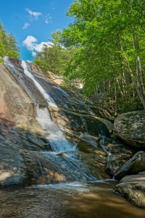
  • Winds its way down in to the Gully Creek valley, passing a small but picturesque waterfall and crossing the stream on step stones and a foot bridge along the way. It climbs again and crosses the summit of Cumberland Knob, which a small grassy...
  • 2.5mi, Climbs Moderately, Moderately Rough

Jumpingoff Rocks Trail

Easy
  • 1mi, ,

Little Glade Millpond Trail

Easy
  • Loop trail around the former mill pond.
  • 0.4mi, ,

Mountains to Sea Section 6 Trail

Most Difficult
  • **Devil's Garden Overlook to Pilot Mountain State Park** Devils Garden Overlook BRP mp 235.7 through Stone Mountain State Park to its headquaters parking area. Follows some named trails, but other trails are to be selected by Stone Mountain State...
  • 67.5mi, Hilly, Moderately Rough

Related Pages