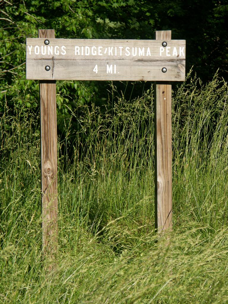
Young's Ridge Trail

At A Glance


4.2 mi one-way
Difficulty Rating: 4.2 ![]()
Steepness: Hilly ![]()
Tread Condition: Some Obstacles ![]()
Trail Number: 205
Description
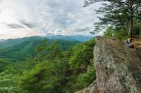
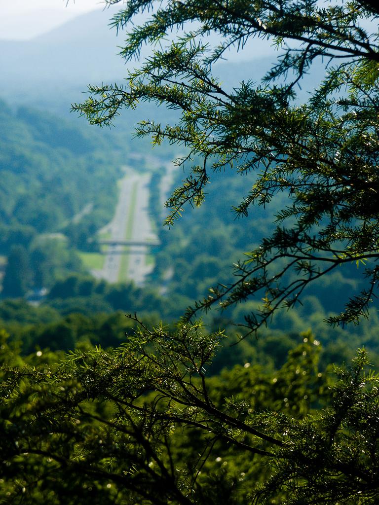
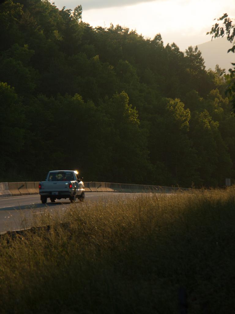
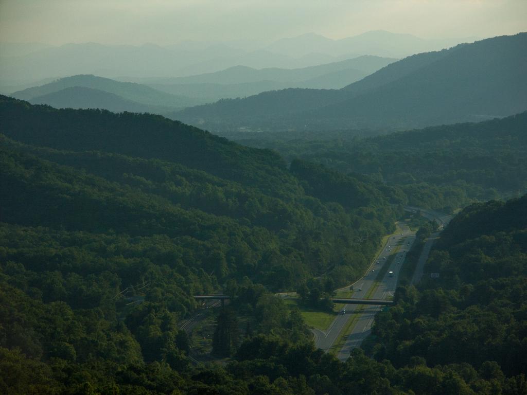
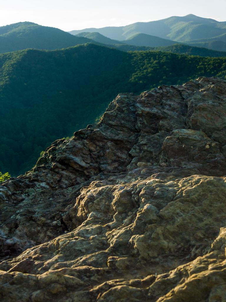
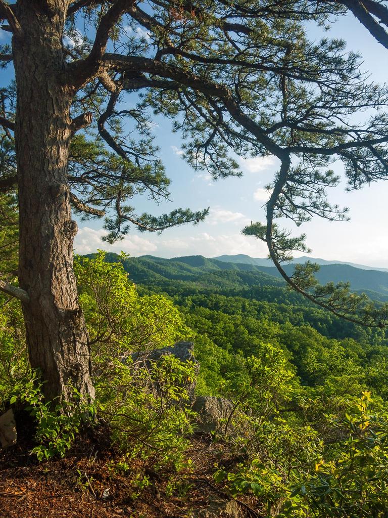
Formerly known as Kitsuma or Kitsuma Peak trail. Starting at the top near Ridgecrest, the trail heads straight out of the back of the parking lot and ascends gently beside I-40. It swings left and climbs more steeply through a set of 12 switchbacks approaching the peak, gaining 500 ft elevation from the parking area. There are wintertime views at switchback #6, and better views at #12 as the trail passes through a grove of uncommon Carolina Hemlock.
(Near the summit, a spur trail signed "Kitsuma Overlook" heads left toward the best views and a campsite at the tippy top of the peak. It's only a good campsite if you like hauling in all your water and listening to trucks engine breaking down the Old Fort Grade all night long. It continues steeply down the ridge past the summit, parallel to the Young's Ridge trail, and re-joins it in about 0.1 mi)
Past the overlook spur, the trail then descends gently along Young's Ridge above the Interstate, with a few more switchbacks and some up-and-down in places, through dry woods and mountain laurel. It then drops off the north side of the ridge into a cove above the Old Fort Picnic Area before ending in the picnic area itself.
Directions
To the upper trailhead:
From Asheville, take I-240 E to I-40 E toward Black Mountain. Go 13 miles and take exit 66 for Ridgecrest. Turn right on to Dunsmore Ave.
Cross the railroad bridge, and immediately take a left on to Yates Ave. Go just under a mile; Yates Ave crosses I-40 again. Turn right onto Royal Gorge Rd. just across I-40. Go 0.2 mi to the parking area at the end of the road.
To the lower trailhead:
The lower end of the trail is at the Old Fort Picnic Area.
This trail is located in the Grandfather Ranger District area. For a list of all the trails in that area, see the Grandfather Ranger District trails list page.
This trail also crosses into these trailhead areas:
All Photos from the Trail


GPS Map
Map Information
Download GPS Data
Click on a route, trail, or point on the map and select the GPS Data tab to download its data.
Data Formats
KML (Google Earth)
KML is the main file type used by Google Earth. If you have Google Earth installed, clicking the KML link should open the trail or point directly in Google Earth for viewing. This is the native file format used by Google Earth, but many other map applications can use and understand KML as well, so if you're not sure which one to download, KML is a good bet.
GPX
The GPX format stands for GPS Exchange - a free, open, XML format for exchanging GPS and map data. GPX is compatible with Google Earth, many other mapping programs, and most GPS devices (such as Garmin). Load the file directly into your GPS to help find your way on your next trip!
GeoJSON
GeoJSON is a newer, lightweight data exchange format which can be used to quickly share map data and may have a smaller size than KML or GPX. Many professional mapping and GIS applications support the GeoJSON format.
About the Map
Copyright
Base Layers
Base layers provided by OpenStreetMap, the US Geological Survey, the US Forest Service, and NC OneMap. Base layer images are subject to the respective copyright policies of their owners. Base layers may not be available at all times due to system maintenance or outages.
WNCOutdoors Base Layer
The WNCOutdoors Base layer is provided by WNCOutdoors.info. It is licensed by Creative Commons Attribution 3.0.
Trail and Marker Overlays
Trail layers and downloadable data are all original works created by WNCOutdoors with guidance from a variety of sources, including ensembles of our own GPS tracks, user contributed GPS tracks, official maps and GIS data from government agencies, and field observations. WNCOutdoors data is made freely available under the Open Database License - you are free to copy and use it for any purpose under the terms of that license (summary).
Tips
- Hover over a trail to see it highlighted. Helps to see start and end points for an individual trail.
- Scroll and zoom the map before printing, and that view will persist into the printed image.
- Click a trail for more details and to download it individually.
Trail Segments
Trails are often made up of several connecting paths which may have different characteristics, allowed uses, and seasons. This trail is divided into multiple segments as follows:
Young's Ridge
- Allowed Uses: Hiking, Mountain Biking
- Length: 0.78 mi
Young's Ridge - Between Kitsuma Overlook
- Allowed Uses: Hiking, Mountain Biking
- Length: 0.14 mi
Young's Ridge - Overlook to Picnic Area
- Allowed Uses: Hiking, Mountain Biking
- Length: 3.55 mi
Kitsuma Overlook - to Campsite Split
- Allowed Uses: Hiking, Mountain Biking
- Length: 119 ft
Kitsuma Overlook - Around Campiste
- Allowed Uses: Hiking, Mountain Biking
- Length: 161 ft
Kitsuma Overlook - Thru Campsite
- Allowed Uses: Hiking, Mountain Biking
- Length: 228 ft
Kitsuma Overlook - Campsite to Overlook
- Allowed Uses: Hiking, Mountain Biking
- Length: 21 ft
Kitsuma Overlook
- Allowed Uses: Hiking, Mountain Biking
- Length: 91 ft
Kitsuma Overlook - Overlook to Young's Ridge
- Allowed Uses: Hiking, Mountain Biking
- Length: 473 ft
Total Calculated Length: 4.68 mi
This value is derived from our underlying map data, and it may not match officially published information.
Feedback
Ratings
Average Rating: 2.0 (rated 73 times)
Rate It Now:

No comments yet.