Trails in the Old Fort Trailhead Area

Here is a list of all trails in the Old Fort Trailhead area.

Each trail has its own printable page with all the information and links, including (where available):

  • directions to the starting point
  • difficulty
  • length
  • elevation change
  • a map
  • photos from along the way, and
  • a detailed description and trail directions.

For general information about the Old Fort trailhead, see the Old Fort Trailhead page.

Need to find trails by another method? Go back to Trails.

Nearby Trails

The following trails cross into this trailhead area, but are primarily accessed from another trailhead:

Young's Ridge Trail

More Difficult
  • Formerly known as Kitsuma or Kitsuma Peak trail. Starting at the top near Ridgecrest, the trail heads straight out of the back of the parking lot and ascends gently beside I-40. It swings left and climbs more steeply through a set of 12 switchbacks...
  • 4.2mi, Hilly, Some Obstacles
  • Grandfather Ranger District Trailhead

Heartbreak Ridge Trail

Most Difficult
  • Descends all the way down the Blue Ridge from the Blue Ridge Parkway near Glass Rock Knob to the Star Gap trail not far from the Old Fort Geyser.
  • 3.9mi, Climbs Moderately, Some Obstacles
  • Grandfather Ranger District Trailhead

Star Gap Trail

More Difficult

East Ridge Trail

More Difficult
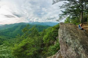
  • Follows the ridge up and over Lookout Mountain, Boggs Bunion, Brushy Mountain and Rocky Head. Ends at Long Gap. here are a few steep sections and several good viewpoints along the trail.
  • 2.48mi, Hilly, Some Obstacles
  • Montreat Trailhead

Old Mitchell Toll Road Trail

Moderate
  • Follows a tourist road which once provided motorized access to the summit of Mount Mitchell from Black Mountain after the logging operations and tourist railroad had winded down. The toll road largely followed the old railroad's path, but the town of...
  • 9.7mi, Climbs Gently, Some Obstacles
  • Montreat Trailhead

Point Lookout Trail

Moderate
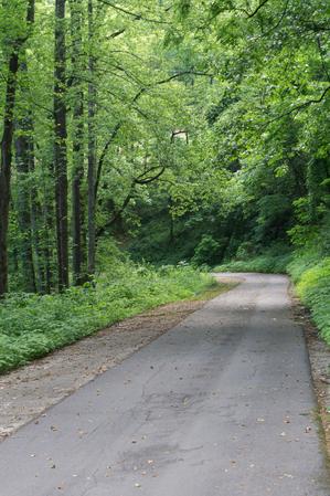
  • This greenway path/trail follows the route of old US Hwy 70 on a steady grade up the Blue Ridge Escarpment from the valley near Old Fort to the top near Ridgecrest. It's a strip of asphalt down the old concrete roadway. Hemmed in by a hardwood and...
  • 3.62mi, Climbs Moderately, Paved
  • Grandfather Ranger District Trailhead