Buckeye Gap Trail

At A Glance


2.85 mi one-way
Difficulty Rating: 2.85 ![]()
Steepness: Climbs Steeply ![]()
Tread Condition: Moderately Rough ![]()
Blaze Color: None
Trail Number: 126
Description
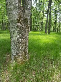
From the lower end at jct. with Haywood Gap Trail, the trail climbs steeply up an old logging skid road near Grassy Ridge Branch. The tread is narrow, but generally in good shape and worn well enough to be obvious. The mountainside here is steep and covered in grass and sedge, with mixed northern hardwoods and an occasional spruce or dying hemlock.
The trail crosses Grassy Ridge Branch above and below some small cascades, moderates some, and then climbs again steeply before reaching the top of what must be named Grassy Ridge (even though it's not on any map). Not surprisingly, the ridge is covered in beautiful soft grasses and sedges - a striking sight when compared to the lush but varied understory common in the area. It then passes through a small clearing. Beyond the clearing, the trail climbs steeply again, with rhododendron and red spruce becoming more common as you ascend.
The trail eventually reaches an old railroad grade and makes a sharp right-hand turn. From there, the grade is gentle, but the tread is a bit rockier (and you have to negotiate some old railroad ties too). There are stands of large red spruce, and some openings where smooth blackberries are overgrowing the trail. There are a few fair views to the West back into the Middle Prong Wilderness. The trail ends where the the Mountains to Sea Trail joins in with the old railroad grade. Straight ahead, the old railroad goes all the way back to connect with the Blue Ridge Parkway at Buckeye Gap.
Intersecting Trails
This trail is located in the Middle Prong Wilderness area. For a list of all the trails in that area, see the Middle Prong Wilderness trails list page.
All Photos from the Trail


GPS Map
Map Information
Download GPS Data
Click on a route, trail, or point on the map and select the GPS Data tab to download its data.
Data Formats
KML (Google Earth)
KML is the main file type used by Google Earth. If you have Google Earth installed, clicking the KML link should open the trail or point directly in Google Earth for viewing. This is the native file format used by Google Earth, but many other map applications can use and understand KML as well, so if you're not sure which one to download, KML is a good bet.
GPX
The GPX format stands for GPS Exchange - a free, open, XML format for exchanging GPS and map data. GPX is compatible with Google Earth, many other mapping programs, and most GPS devices (such as Garmin). Load the file directly into your GPS to help find your way on your next trip!
GeoJSON
GeoJSON is a newer, lightweight data exchange format which can be used to quickly share map data and may have a smaller size than KML or GPX. Many professional mapping and GIS applications support the GeoJSON format.
About the Map
Copyright
Base Layers
Base layers provided by OpenStreetMap, the US Geological Survey, the US Forest Service, and NC OneMap. Base layer images are subject to the respective copyright policies of their owners. Base layers may not be available at all times due to system maintenance or outages.
WNCOutdoors Base Layer
The WNCOutdoors Base layer is provided by WNCOutdoors.info. It is licensed by Creative Commons Attribution 3.0.
Trail and Marker Overlays
Trail layers and downloadable data are all original works created by WNCOutdoors with guidance from a variety of sources, including ensembles of our own GPS tracks, user contributed GPS tracks, official maps and GIS data from government agencies, and field observations. WNCOutdoors data is made freely available under the Open Database License - you are free to copy and use it for any purpose under the terms of that license (summary).
Tips
- Hover over a trail to see it highlighted. Helps to see start and end points for an individual trail.
- Scroll and zoom the map before printing, and that view will persist into the printed image.
- Click a trail for more details and to download it individually.
Feedback
Ratings
Average Rating: 4.0 (rated 1 times)
Rate It Now:

Rachael Eley said: The mileage on this trail depending on the source is erroneous. According to the map, the trail is 3.4 miles. This trail is gorgeous and has access on the southside from the Mountains to Sea trail or the Northside from Haywood Gap. We hiked it from South to NW. Starting at Mountains to Sea trail toward Haywood Gap. The trail head is located approximately 3.0 miles from Haywood gap East. The trails are not marked, but is quite obvious. About 0.5 mile after crossing Buckeye Creek, Buckeye Gap goes straight (NW) and MTS trail curves off to the right (East). The trail begins about 1.5 miles as a pretty gentle grade through meadows and cradles and the descent is moderate. Buckeye crosses a small creek and then gets pretty narrow and steep as it continues another mile or so to Haywood gap trail. Turn right (north to take Haywood to FS 97 near Sunburst Campground. We went left (south) back toward Mountains to Sea trail. Rating South to North. Moderate hiking with some steep down descents for short distances. Rating North to South. Moderate to strenuous just for those short pushes upward.