Art Loeb Section 1 Trail

At A Glance


12.3 mi one-way
Difficulty Rating: 12.3 ![]()
Steepness: Level ![]()
Tread Condition: Few Obstacles ![]()
Blaze Color: White
Description
Starting at the Davidson River Campground, the trail ascends Shut-in Ridge (not to be confused with the Shut-in Ridge near the French Broad River further north, where the long Shut-in Trail begins). It travels through Cat Gap, around the south side of Cedar Rock Mountain, and down into Gloucester Gap, marking the end of section 1.
Intersecting Trails
This trail is located in the Davidson River area. For a list of all the trails in that area, see the Davidson River trails list page.
All Photos from the Trail


GPS Map
Map Information
Download GPS Data
Click on a route, trail, or point on the map and select the GPS Data tab to download its data.
Data Formats
KML (Google Earth)
KML is the main file type used by Google Earth. If you have Google Earth installed, clicking the KML link should open the trail or point directly in Google Earth for viewing. This is the native file format used by Google Earth, but many other map applications can use and understand KML as well, so if you're not sure which one to download, KML is a good bet.
GPX
The GPX format stands for GPS Exchange - a free, open, XML format for exchanging GPS and map data. GPX is compatible with Google Earth, many other mapping programs, and most GPS devices (such as Garmin). Load the file directly into your GPS to help find your way on your next trip!
GeoJSON
GeoJSON is a newer, lightweight data exchange format which can be used to quickly share map data and may have a smaller size than KML or GPX. Many professional mapping and GIS applications support the GeoJSON format.
About the Map
Copyright
Base Layers
Base layers provided by OpenStreetMap, the US Geological Survey, the US Forest Service, and NC OneMap. Base layer images are subject to the respective copyright policies of their owners. Base layers may not be available at all times due to system maintenance or outages.
WNCOutdoors Base Layer
The WNCOutdoors Base layer is provided by WNCOutdoors.info. It is licensed by Creative Commons Attribution 3.0.
Trail and Marker Overlays
Trail layers and downloadable data are all original works created by WNCOutdoors with guidance from a variety of sources, including ensembles of our own GPS tracks, user contributed GPS tracks, official maps and GIS data from government agencies, and field observations. WNCOutdoors data is made freely available under the Open Database License - you are free to copy and use it for any purpose under the terms of that license (summary).
Tips
- Hover over a trail to see it highlighted. Helps to see start and end points for an individual trail.
- Scroll and zoom the map before printing, and that view will persist into the printed image.
- Click a trail for more details and to download it individually.
Trail Segments
Trails are often made up of several connecting paths which may have different characteristics, allowed uses, and seasons. This trail is divided into multiple segments as follows:
Art Loeb - Estatoe - Art Loeb Parking to Bridge
- Allowed Uses: Hiking
- Length: 0.23 mi
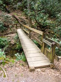
Art Loeb - Estatoe Bridge
- Allowed Uses: Hiking
- Length: 108 ft
Art Loeb - Estatoe - Bridge to Split
- Allowed Uses: Hiking
- Length: 0.48 mi
Art Loeb Section 1
- Allowed Uses: Hiking
- Length: 11.54 mi
Total Calculated Length: 12.26 mi
This value is derived from our underlying map data, and it may not match officially published information.
Feedback
Ratings
Average Rating: 5.0 (rated 1 times)
Rate It Now:

Jaybird said: This section of the trail is awesome..... if you love elevation change. While 12 miles in length, that doesn't account for the steep changes of up and down along the route. Its a walk... not for a beginner hiker, especially if you are walking with overnight gear in cold weather. I did this section in November with @ 30lb of gear and my 40 yr old knees were so sore in the morning that I could barely walk back out. But still, I loved it. It was my fault for not being better prepared and for over-packing... and for not having walking sticks. The part that killed my knees were the descents with a heavy pack. All that shock on the knees was too much. This is a great hike to test out whether your ultra-light setup is good enough.