Fletcher Creek Trail

At A Glance


2.4 mi one-way
Difficulty Rating: 2.4 ![]()
Steepness: Climbs Moderately ![]()
Tread Condition: Some Obstacles ![]()
Blaze Color: Blue
Trail Number: 350
Description
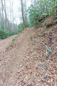
Typical streamside trail for the most part, with cove hardwood forests, hemlocks, fern gardens and log bridges. Some muddy sections are out there, but the trail is mostly dry. It passes through some open meadows rimmed with flowering dogwoods near its upper end. These fields have been used to grow corn in years recently past; they can become overgrown with weeds in the summer. Follows the old Fletcher Creek Road.
Note: the log bridge at the intersection with the Spencer Branch and Middle Fork trails was washed away during the storms of September, 2004, so this is now a wet crossing.
Intersecting Trails
This trail is located in the Mills River area. For a list of all the trails in that area, see the Mills River trails list page.
All Photos from the Trail


GPS Map
Map Information
Download GPS Data
Click on a route, trail, or point on the map and select the GPS Data tab to download its data.
Data Formats
KML (Google Earth)
KML is the main file type used by Google Earth. If you have Google Earth installed, clicking the KML link should open the trail or point directly in Google Earth for viewing. This is the native file format used by Google Earth, but many other map applications can use and understand KML as well, so if you're not sure which one to download, KML is a good bet.
GPX
The GPX format stands for GPS Exchange - a free, open, XML format for exchanging GPS and map data. GPX is compatible with Google Earth, many other mapping programs, and most GPS devices (such as Garmin). Load the file directly into your GPS to help find your way on your next trip!
GeoJSON
GeoJSON is a newer, lightweight data exchange format which can be used to quickly share map data and may have a smaller size than KML or GPX. Many professional mapping and GIS applications support the GeoJSON format.
About the Map
Copyright
Base Layers
Base layers provided by OpenStreetMap, the US Geological Survey, the US Forest Service, and NC OneMap. Base layer images are subject to the respective copyright policies of their owners. Base layers may not be available at all times due to system maintenance or outages.
WNCOutdoors Base Layer
The WNCOutdoors Base layer is provided by WNCOutdoors.info. It is licensed by Creative Commons Attribution 3.0.
Trail and Marker Overlays
Trail layers and downloadable data are all original works created by WNCOutdoors with guidance from a variety of sources, including ensembles of our own GPS tracks, user contributed GPS tracks, official maps and GIS data from government agencies, and field observations. WNCOutdoors data is made freely available under the Open Database License - you are free to copy and use it for any purpose under the terms of that license (summary).
Tips
- Hover over a trail to see it highlighted. Helps to see start and end points for an individual trail.
- Scroll and zoom the map before printing, and that view will persist into the printed image.
- Click a trail for more details and to download it individually.
Trail Segments
Trails are often made up of several connecting paths which may have different characteristics, allowed uses, and seasons. This trail is divided into multiple segments as follows:
Fletcher Creek - Neverending Rd. to Middle Fork Tr.
- Allowed Uses: Hiking, Mountain Biking, Horseback Riding
- Length: 1.2 mi
Fletcher Creek - Fletcher Creek to Hend. Res. Rd.
- Allowed Uses: Hiking, Mountain Biking, Horseback Riding
- Length: 1.16 mi
Fletcher Creek Crossing
- Allowed Uses: Hiking, Mountain Biking, Horseback Riding
- Length: 127 ft
Total Calculated Length: 2.38 mi
This value is derived from our underlying map data, and it may not match officially published information.
Feedback
Ratings
Average Rating: (rated 0 times)
Rate It Now:

Melanie S said: I would really know how/where to access this trail...(trailhead?) and where I can park to get to it. Any advice? Thanks
[Site Admin] Jordan M. said: Lisa - that's a great idea and something we've been thinking about how to do properly. For now, we recommend using our Best Hikes section if you need more guidance than the raw trail details provide. Thanks for the comments and it's something we'll work to improve!
Lisa Lewis said: Please tell us where the trailhead is. An address or some way to find parking would make the useful, and not just pretty.