Old Mitchell Toll Road Trail

At A Glance


9.7 mi one-way
Difficulty Rating: 14.1 ![]()
Steepness: Climbs Gently ![]()
Tread Condition: Some Obstacles ![]()
Lowest Elevation: 3250 ft
Highest Elevation: 5200 ft
Climb Total: 1950 ft
Blaze Color: None
Description
Follows a tourist road which once provided motorized access to the summit of Mount Mitchell from Black Mountain after the logging operations and tourist railroad had winded down. The toll road largely followed the old railroad's path, but the town of Montreat wanted the road moved to the other side of the ridge in places to minimize traffic noise in the valley, so these have become parallel paths in places. These re-routed sections are betwen Rainbow Gap and Sourwood Gap, and between Long Gap and the last junction north of Graybeard Falls.
Note: closed to travel during bear hunting season beyond Sourwood Gap. Use East Ridge and Old Trestle Road trails to reach the Graybeard trail farther north during the winter months. The southernmost portion of the road is on private property not normally open to the public, but the road can be accessed via Montreat's Rainbow Mountain and/or Rainbow Road trails. Distance includes only the portion normally open to travel.
Intersecting Trails
This trail is located in the Montreat area. For a list of all the trails in that area, see the Montreat trails list page.
This trail also crosses into these trailhead areas:
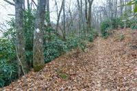
All Photos from the Trail


GPS Map
Map Information
Download GPS Data
Click on a route, trail, or point on the map and select the GPS Data tab to download its data.
Data Formats
KML (Google Earth)
KML is the main file type used by Google Earth. If you have Google Earth installed, clicking the KML link should open the trail or point directly in Google Earth for viewing. This is the native file format used by Google Earth, but many other map applications can use and understand KML as well, so if you're not sure which one to download, KML is a good bet.
GPX
The GPX format stands for GPS Exchange - a free, open, XML format for exchanging GPS and map data. GPX is compatible with Google Earth, many other mapping programs, and most GPS devices (such as Garmin). Load the file directly into your GPS to help find your way on your next trip!
GeoJSON
GeoJSON is a newer, lightweight data exchange format which can be used to quickly share map data and may have a smaller size than KML or GPX. Many professional mapping and GIS applications support the GeoJSON format.
About the Map
Copyright
Base Layers
Base layers provided by OpenStreetMap, the US Geological Survey, the US Forest Service, and NC OneMap. Base layer images are subject to the respective copyright policies of their owners. Base layers may not be available at all times due to system maintenance or outages.
WNCOutdoors Base Layer
The WNCOutdoors Base layer is provided by WNCOutdoors.info. It is licensed by Creative Commons Attribution 3.0.
Trail and Marker Overlays
Trail layers and downloadable data are all original works created by WNCOutdoors with guidance from a variety of sources, including ensembles of our own GPS tracks, user contributed GPS tracks, official maps and GIS data from government agencies, and field observations. WNCOutdoors data is made freely available under the Open Database License - you are free to copy and use it for any purpose under the terms of that license (summary).
Tips
- Hover over a trail to see it highlighted. Helps to see start and end points for an individual trail.
- Scroll and zoom the map before printing, and that view will persist into the printed image.
- Click a trail for more details and to download it individually.
Trail Segments
Trails are often made up of several connecting paths which may have different characteristics, allowed uses, and seasons. This trail is divided into multiple segments as follows:
"Alternate Rainbow Road" - Rainbow Rd to Rainbow Gap
- Allowed Uses: Hiking, Horseback Riding
- Length: 0.15 mi
Old Mitchell Toll Rd - Lookout to High Ridge Tr
- Allowed Uses: Hiking, Horseback Riding
- Length: 0.71 mi
Old Mitchell Toll Rd - High Ridge Tr to Heliport
- Allowed Uses: Hiking, Horseback Riding
- Length: 0.67 mi
Old Mitchell Toll Rd - Buck Gap to Sourwood Gap
- Allowed Uses: Hiking, Horseback Riding
- Length: 0.69 mi
Old Mitchell Toll Rd - thru Sourwood Gap
- Allowed Uses: Hiking, Horseback Riding
- Length: 59 ft
Old Mitchell Toll Rd - Sourwood Gap to Birch Ridge
- Allowed Uses: Hiking, Horseback Riding
- Length: 0.59 mi
Old Mitchell Toll Rd - Birch Ridge to Long Gap
- Allowed Uses: Hiking, Horseback Riding
- Length: 0.33 mi
Old Mitchell Toll Rd - thru Long Gap
- Allowed Uses: Hiking, Horseback Riding
- Length: 216 ft
Old Mitchell Toll Rd - Long Gap to Pot Gap
- Allowed Uses: Hiking, Horseback Riding
- Length: 1.01 mi
Old Mitchell Toll Rd - Pot Gap to Slaty Branch
- Allowed Uses: Hiking, Horseback Riding
- Length: 1.19 mi
Old Mitchell Toll Rd - Slaty Branch to Old Trestle Road
- Allowed Uses: Hiking, Horseback Riding
- Length: 0.41 mi
Old Mitchell Toll Rd - Old Trestle Road to Ridge above Slaty Branch
- Allowed Uses: Hiking, Horseback Riding
- Length: 0.42 mi
Old Mitchell Toll Rd - Ridge above Slaty Branch to Rocky Knob
- Allowed Uses: Hiking, Horseback Riding
- Length: 1.1 mi
Old Mitchell Toll Rd - Rocky Knob Tr to Pinnacle Tr
- Allowed Uses: Hiking, Horseback Riding
- Length: 1.5 mi
Old Mitchell Toll Rd - Pinnacle Tr to Parkway
- Allowed Uses: Hiking, Horseback Riding
- Length: 0.6 mi
Old Mitchell Toll Rd - Heliport to Buck Gap
- Allowed Uses: Hiking, Horseback Riding
- Length: 0.27 mi
Total Calculated Length: 9.7 mi
This value is derived from our underlying map data, and it may not match officially published information.
Feedback
Ratings
Average Rating: (rated 0 times)
Rate It Now:

No comments yet.