Trails in the Linville Falls Trailhead Area

Here is a list of all trails in the Linville Falls Trailhead area.

Each trail has its own printable page with all the information and links, including (where available):

  • directions to the starting point
  • difficulty
  • length
  • elevation change
  • a map
  • photos from along the way, and
  • a detailed description and trail directions.

For general information about the Linville Falls trailhead, see the Linville Falls Trailhead page.

Need to find trails by another method? Go back to Trails.

Duggers Creek Trail

Easy
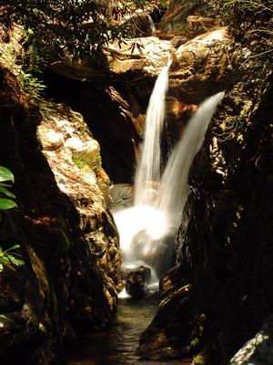
  • A short loop path leads through rhododendrons, up a small grade, and over a few roots and rocks to the falls at a footbridge. This is sometimes called "The smallest named falls on the Blue Ridge Parkway", but its beauty is outsized - and well worth...
  • 0.25mi, Climbs Gently, Some Obstacles

Erwins View Trail

Moderate
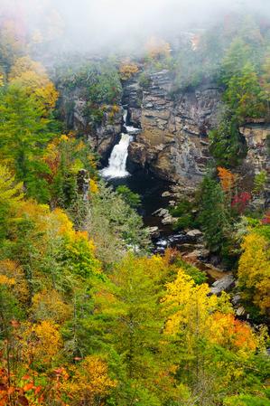
  • This trail travels to four excellent views of the Upper and Lower Falls. The first overlook takes you to the pool at Upper Falls. From this vantage point you can see the river pouring into the narrorw gorge above the lower falls. The second...
  • 0.8mi, Some Hills, Some Obstacles

Plunge Basin Trail

Moderate
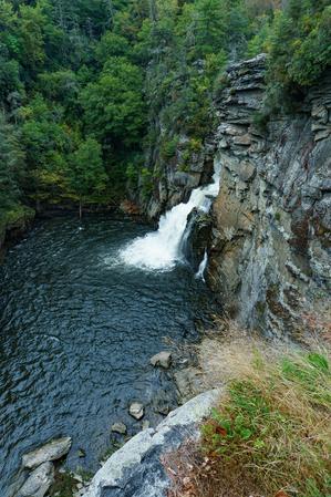
  • From the visitor center, this trail starts out fairly smooth through a forest of very large hemlocks and white pines to the junction with the Plunge Basin overlook split. The trail to the overlook is downhill and has some obstacles, but is well...
  • 0.7mi, Climbs Moderately, Moderately Rough

Related Pages