Trails in the Curtis Creek Trailhead Area

Here is a list of all trails in the Curtis Creek Trailhead area.

Each trail has its own printable page with all the information and links, including (where available):

  • directions to the starting point
  • difficulty
  • length
  • elevation change
  • a map
  • photos from along the way, and
  • a detailed description and trail directions.

For general information about the Curtis Creek trailhead, see the Curtis Creek Trailhead page.

Need to find trails by another method? Go back to Trails.

Hickory Branch Trail

More Difficult
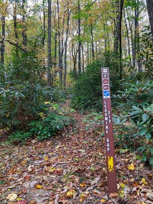
  • The orange-blazed trail starts across the road from the parking area, on the hill behind campsite #16c. Look for the tall brown stake which serves as the trailhead sign. The trail begins by climbing to the top of the ridge. Don't go straight up; turn...
  • 1.6mi, Climbs Moderately, Some Obstacles

Lead Mine Gap Trail

More Difficult
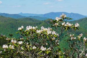
  • Starting at Curtis Creek Road, travels south along the ridge with stellar views. Past the junction with Hickory Branch Trail, descends to Mackey Creek Road on an unmaintained segment.
  • 3.73mi, Hilly, Moderately Rough

Mackey Mountain Trail

Most Difficult
  • The infamous Mackey Mountain trail starts near the top of Curtis Creek Road and heads southeast. This trail begins well enough, winding along and across the ridgeline past Sams Knob and over to Narrows Knob. It's a well-graded path in most places,...
  • 8mi, Hilly, Moderately Rough

Snooks Nose Trail

Most Difficult
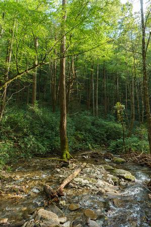
  • Starting the Curtis Creek campground, the trail winds its way into the cove containing Slick Falls Branch on an old logging road, and then begins its signature climb. This is one steep trail! There are a few switchbacks, but they don't minimize the...
  • 4mi, Climbs Steeply, Moderately Rough

Sugar Cove Trail

Moderate
  • Old road converted to trail. Connects the Curtis Creek area over to the Buck Creek drainage via Sugar Cove Creek.
  • 2.5mi, Climbs Moderately, Some Obstacles