Using this information, you can combine these trails into several day hikes or overnight trips on loops or out-and-back routes to your favorite landmarks. If you would like more guidance, we also provide complete information - including maps, directions, descriptions, and photos - to guide you along what we consider to be the best hikes using these trails.
Here is a list of all trails in the Panthertown Valley Trailhead area.
Each trail has its own printable page with all the information and links, including (where available):
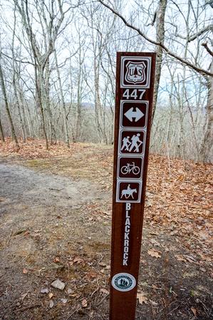
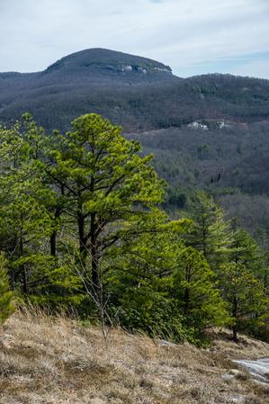
A mostly ridge-top trail offering wintertime views in all directions. Climbs moderately and has moderate erosion along its length, leading to the Moderately Rough rating. Connects with the Overlook trail just past the summit of Blackrock Mountain to...
From the North Road trail, this one starts out going uphill steeply at first, loosely following an old logging road or skid trail. It passes through a couple of switchbacks, one of which is at a small wet-weather stream with a shallow water slide....
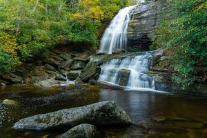
Starting at the Panthertown Valley trail downhill from Salt Rock, this trail descends to cross Frolictown Creek just above its small, scenic waterfall. Be careful at the crossing - it's slippery and the falls are just downstream. The trail is an old...
In addition to providing access to the long, sliding Granny Burrell Falls, and the huge pool downstream of them, this trail travels near some neat portions of Panthertown Creek. A Carlton McNeil classic, it twists and turns through some of the...
This trail was previously considered two trails by most, but the Forest Service has officially combined them into one. For this reason, it has two distinct characters on the two different sections that now share the same name. Starting on the Deep...
Formerly called Carlton's Way, named after Carlton McNeil. Carlton was a nearby resident who loved the Panthertown valley and was known locally as its "keeper". He blazed many of the trails in the area, including this one, and his trails...
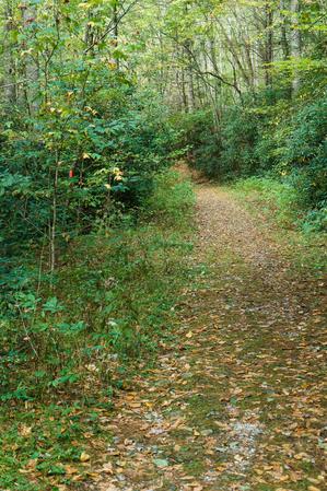
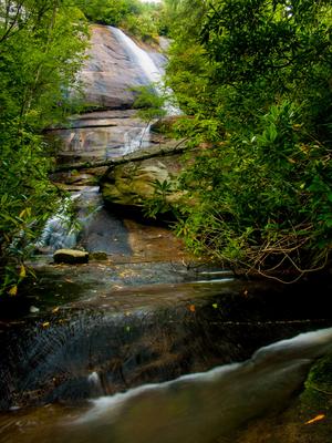
{{fig right img="2018-10-14_panthertown-valley_little-green-trail-schoolhouse-falls-autumn.jpg"}}
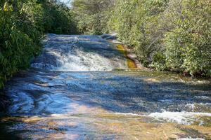
This trail first takes you to Schoolhouse Falls (if starting on the northeast end at the Panthertown Valley trail where it crosses Greenland Creek,...
Provides the quickest access to Greenland Creek Falls from the Cold Mountain trailhead on an old road bed. Then, ascends into the heart of the valley and descends again between Big and Little Green Mountains. Can be used to make a ton of loop options...
Crosses the very summit of Blackrock Mountain before descending to the cliff areas for spectacular 180-degree views of Big and Little Green Mountains, and the entire Panthertown valley. The cliff-top viewing area has some nice flat spots to hang out...
This is the main trail through the valley which stretches from the Cold Mountain entrance to the Salt Rock entrance. Portions of this trail are open to horses and/or bikes. It passes near many of the main attractions within the valley, so many loop...
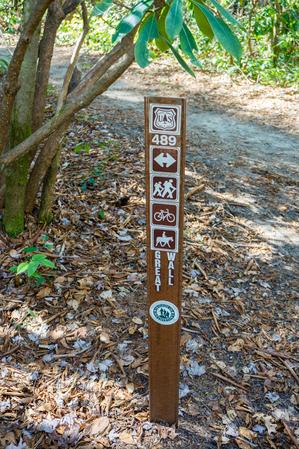
Formerly called the Green Creek trail. Passes near Riding Ford, Jawbone, and Warden's falls. Can be used with Powerline Road, Devil's Elbow, and Panthertown Valley trails for a great loop.
Starting just west of Salt Rock along the Panthertown Valley trail, this trail descends on a path with three distinct characters, past the base of Wilderness Falls. The upper portion is not recommended until a re-route of the middle section is...