All the Best Hikes in WNC
Hikes by Difficulty: Easy | Moderate | More Difficult | Most Difficult | All
This page includes all the Best Hikes on this site, in alphabetical order.
Each hike has its own printable guide page with all the information and links, including (where available):
- directions to the starting point
- length
- difficulty
- elevation change
- an interactive topo map
- photos from along the way
- a detailed description and trail directions, and
- a place to leave comments about your experiences
All Hikes
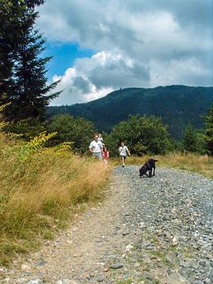
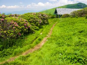
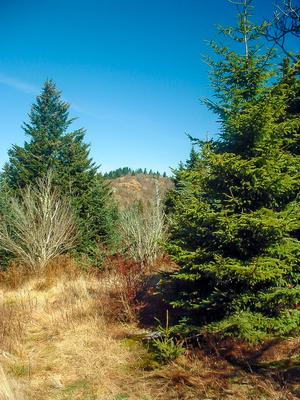
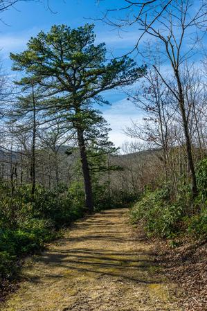
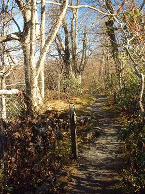
Camp Alice/Commissary Hike


- This is a high-elevation hike that, while providing the same storied Black Mountains scenery, is both easier and less often used than some of the park's other trails, offering a chance for silence and solitude. Trees and meadows with a decidedly...
- 2.0 - 3.6mi, Climbs Gently
- Tread Condition: Few Obstacles
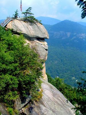
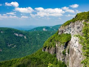
Chimney Rock Tour Hike

- The short description of this hike could simply be "Hike all of Chimney Rock's trails!" Though Chimney Rock may resemble a theme park more than it does a wilderness, the trail network provides a way to enjoy the park from a more natural perspective....
- 4.5mi, Climbs Steeply
- Tread Condition: Some Obstacles
Cove Creek and Caney Bottom Hike

- Beautiful Pisgah scenery abounds on this classic loop hike, which travels past several nice waterfalls, through some flats above the Davidson River valley, and around seepage bogs and open, fern-filled woods. It's moderate overall; some of the...
- 4.2mi, Climbs Moderately
- Tread Condition: Moderately Rough
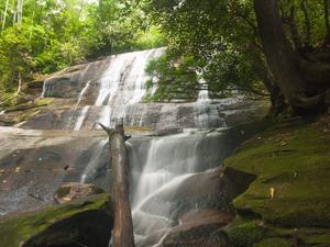
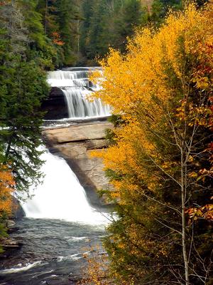
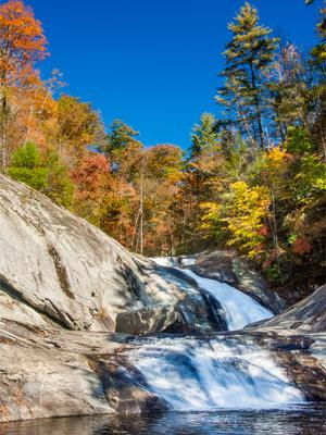
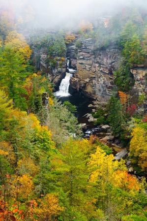
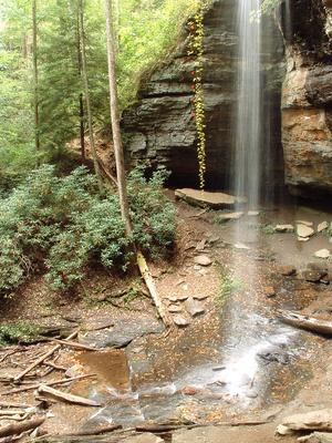
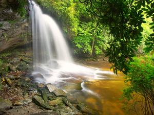
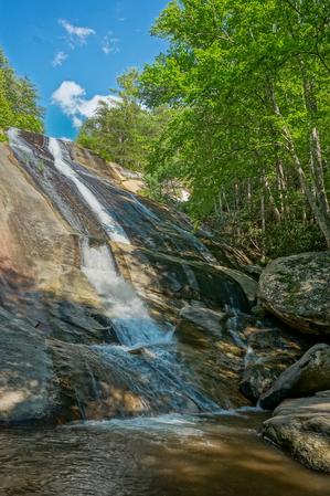
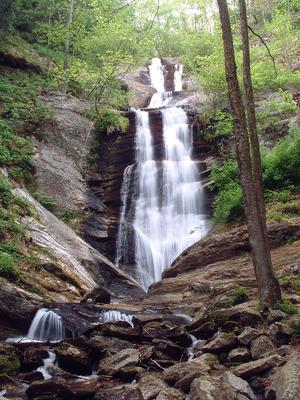
Crabtree Falls Hike
- This popular, short loop descends on a moderate path to a majestic 70 ft waterfall, which is widely touted as one of the most photogenic in the area. You'll climb steeply up the opposite ridge for a short distance, then hike a wide, smooth trail...
- 3mi, Hilly
- Tread Condition: Some Obstacles
Craggy Gardens Hike
- This self-guiding nature trail passes through a high-elevation Northern Hardwood forest to a Heath Bald, and finally into a Grassy Summit. A large trail shelter makes an excellent spot for a picnic. Visit during mid to late June for a spectacular...
- 1.4mi, Climbs Moderately
- Tread Condition: Some Obstacles
Craggy Pinnacle Hike
- This popular trail climbs a short distance from a Blue Ridge Parkway overlook to a high, rocky peak with commanding views of the Craggy Gardens area. Blooming rhododendrons put on a fantastic display along this trail in late June. Twisted trees grow...
- 1.4mi, Climbs Moderately
- Tread Condition: Some Obstacles
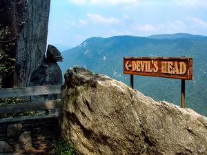
Devil's Courthouse Hike
- This hike takes you to the summit of Devil's Courthouse, a high-elevation rocky summit with a fantastic cliff-top overlook. But this isn't the usual route used by most casual tourists, which is a paved trail starting at a Parkway overlook. Rather,...
- 4.3mi, Climbs Moderately
- Tread Condition: Moderately Rough
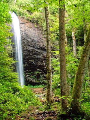
Douglas Falls (Lower Approach) Hike
- This spectacular, 70 ft. falls is located in an old-growth forest. The lower approach to the falls is a walk on a gently sloped trail to its base. The hike is markedly changed from years past; though the hemlocks in the area are dead, you'll travel...
- 1mi, Climbs Gently
- Tread Condition: Moderately Rough
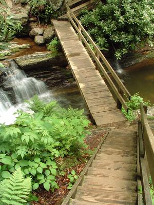
Dupont Waterfalls and Lakes Tour Hike
- On this hike, you'll visit up to 5 of the 6 major waterfalls and 3 of the beautiful lakes in Dupont State Forest. It starts as an easy path to some of the most spectacular waterfalls in the area: Hooker, Triple, and High Falls. Covered picnic...
- 0.75 - 10.0mi, Climbs Moderately
- Tread Condition: Some Obstacles
Firescald Knob Hike
- Comprising one of the easier destination hikes in North Carolina's Shelton Laurel area of Pisgah National Forest (and winding into Tennessee's Cherokee National Forest as well), a portion of the Appalachian Trail near Camp Creek Bald invites day...
- 4.5mi, Hilly
- Tread Condition: Moderately Rough
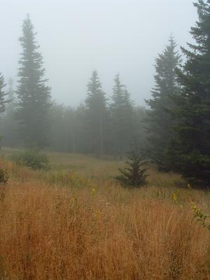
Flat Laurel Creek Hike
- This loop takes you around the headwaters basin of Flat Laurel Creek, which starts in a unique, high-elevation valley surrounded by sharp peaks, grassy balds, and cool, dark, spruce-fir forests. Its elevation is over 5300 ft at the bottom, and it...
- 2.5mi, Climbs Gently
- Tread Condition: Moderately Rough
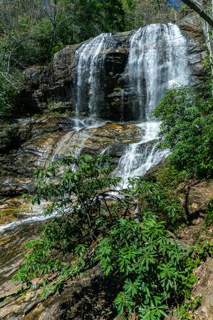
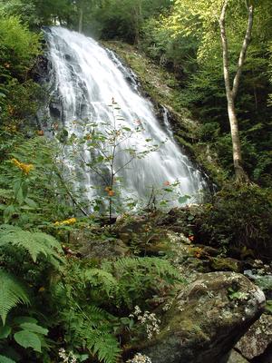
Glen Falls Hike
- This trail takes the hiker through a pleasant forest of hardwoods and pines to one of the spectacular waterfalls of the Blue Ridge Escarpment. As Overflow Creek plunges over the ledge below one of the East's highest towns, you really get two falls in...
- 1.1mi, Climbs Steeply
- Tread Condition: Moderately Rough
Grandfather's Profile Hike

- Ascending Grandfather Mountain's Profile Trail, this hike takes you past some of the features that inspired its name. You'll ascend from the middle elevation creeks and streams, past a variety of features including views and rock outcroppings, and...
- 7.6mi, Climbs Steeply
- Tread Condition: Moderately Rough
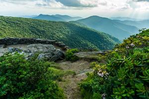
Graveyard Fields Hike
- A unique loop trail winds through this high-elevation, flat valley. Two spurs lead to some of the most photographed and enjoyed waterfalls in the state! You'll pass through open areas, stands of Mountain Laurel and Rhododendron, and young northern...
- 3.2mi, Hilly
- Tread Condition: Some Obstacles
Graybeard Mountain Hike
- A fantastic, classic summit hike starts in the shadows of a deep valley and culminates atop one of Western North Carolina's preeminent 5000-footers. The hike features widely varied scenery in an area managed as wilderness, yet the trails are well...
- 8.8 - 9.1mi, Climbs Steeply
- Tread Condition: Moderately Rough
Great Woodland Adventure Hike
- Winding through the woods below Chimney Rock is the Great Woodland Adventure trail, a Kids In Parks TRACK Trail which aims to engage kids in learning about all that can be found in the forest. A perfect introductory hike for families with small...
- 0.6mi, Climbs Gently
- Tread Condition: Graveled
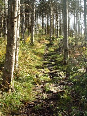
Green Knob Hike
- This hike takes you along the Mountains to Sea Trail in a remote section of the Pisgah National Forest. The entire hike is above 5000 ft in elevation, and you'll explore forests of oaks, birches, beeches, spruces and firs. You'll cross the headwaters...
- 9mi, Hilly
- Tread Condition: Some Obstacles
Harper Creek Falls Hike
- A wilderness experience awaits along Harper Creek. This is not your typical, easy hike to Harper Creek Falls. However, this is a relatively gentle encounter with wilderness due to its short length, moderate grade, and sparse (but useful) trail...
- 8.5mi, Hilly
- Tread Condition: Very Rough
Hickory Nut Falls Hike
- This moderate hike takes you out-and-back through a vibrant forest to the base of Hickory Nut Falls. This is a very high and neat waterfall. You'll travel along the base of the cliffs that form the edge of the Hickory Nut Gorge and the Falls. Trees...
- 1.5mi, Climbs Gently
- Tread Condition: Some Obstacles
John Rock Loop Hike
- This hike takes you past a small but attractive waterfall, up to the top of John Rock, which is the large mountain you see looming behind the Fish Hatchery parking area in Pisgah National Forest. Views of the valley below, up to the Pisgah Ridge, and...
- 5mi, Climbs Steeply
- Tread Condition: Moderately Rough
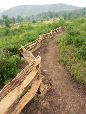
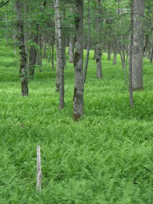
Licklog Hike
- This is an easy, scenic hike with a silly name making it kid-friendly! It consists of a pleasant walk along a rolling, grassy forest road ending in three wildlife meadows. Along the way, you'll enjoy a beautiful, varied forest with conifers normally...
- 1.8mi, Climbs Gently
- Tread Condition: Few Obstacles
Linville Falls - Erwin's View Hike
- Linville Falls has two main trails: Erwin's view and Plunge Basin. Erwin's view is the easier of the two, and stops at three main overlooks: Upper Falls, Chimney View, and the eponymous Erwin's View. This trail passes through a majestic forest of...
- 1.5mi, Few Hills
- Tread Condition: Some Obstacles
Linville Falls - Plunge Basin Hike
- A short but rugged trail takes you to the base of this impressive falls; the roughness is mitigated somewhat since it's short. Stare up at the gorge walls and marvel at the water churning through a narrow chasm before plunging into the deep pool at...
- 1.4 - 1.8mi, Climbs Steeply
- Tread Condition: Moderately Rough
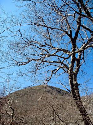
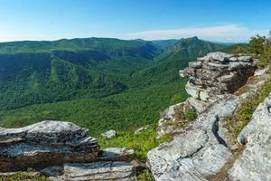
Looking Glass Rock Hike
- This hike takes you to the top of a Pisgah National Forest icon: the huge granitic pluton known as Looking Glass Rock. Visible from many locations along the Blue Ridge Parkway and found on postcards in every gift shop in the region, the summit of the...
- 6.4mi, Climbs Steeply
- Tread Condition: Moderately Rough
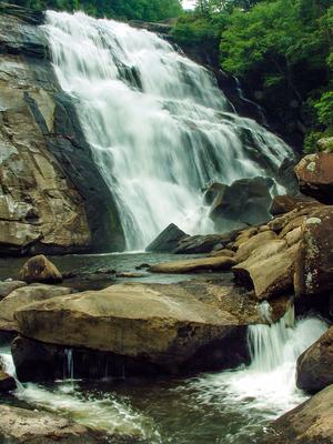
Moore Cove Falls Hike
- This showery plunging waterfall is located in one of the most popular areas of the Pisgah National Forest, near the Davidson River in the "Land of Waterfalls". It's a delightful, beautiful walk thru fern-filled woods. And it's easy enough for...
- 1.4mi, Climbs Gently
- Tread Condition: Few Obstacles
Mount Mitchell Hike
- Starting at the Black Mountain Campground on the Toe River, this hike gains 3600 ft in elevation over 5 1/2 miles to reach the summit of the East's highest peak, making it one of the toughest continuous climbs in the region, near the limit of what...
- 11.4mi, Climbs Steeply
- Tread Condition: Moderately Rough
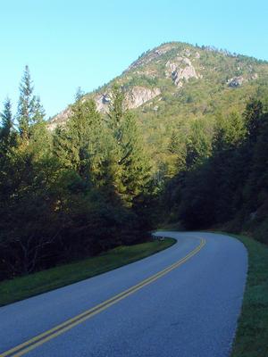
Mount Pisgah Hike
- A classic Blue Ridge Parkway hike, this trail continues onto National Forest land to climb to the summit of one of the area's most well-known peaks, which lends its name to numerous other things throughout the region. Mount Pisgah is part of the...
- 3mi, Climbs Moderately
- Tread Condition: Moderately Rough
Old Mitchell Hike
- Don't be like the rest of the tourists and drive to the top: take a real hike to the summit of Mount Mitchell! This moderate trail climbs from the park's restaurant roughly 2 miles to the summit along a beautiful trail that is both historic and yet...
- 4mi, Hilly
- Tread Condition: Moderately Rough
Panthertown Valley Tour Hike
- This is a large loop with a wide variety of main attractions. The trails will take you past lazy, meandering streams with clean white sandbars, yet you'll discover 5 major waterfalls as well. You'll explore the unusual, flat-bottomed, high-elevation...
- 8.8 - 10.0mi, Hilly
- Tread Condition: Moderately Rough
Pilot Cove Loop Hike
- A beautiful view awaits at the top of this classic Pisgah hike.
- mi,
- Tread Condition:
Pink Beds Loop Hike
- This relatively flat loop hike - which features a shortcut option - is all about water. You'll see rare mountain bogs, including glimpses of some rare and endangered species of plants if you're lucky. You'll pass through a forest in transition, as...
- 5.1mi, Few Hills
- Tread Condition: Some Obstacles
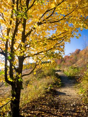
Potato Knob Fields Hike
- A well-known area landmark, Potato Knob is a rocky, prominent peak visible from the Blue Ridge Parkway, many points in the foothills region, and along I-40. This hike takes you on a spectacular section of the Mountains to Sea Trail below the peak...
- 2mi, Climbs Moderately
- Tread Condition: Moderately Rough
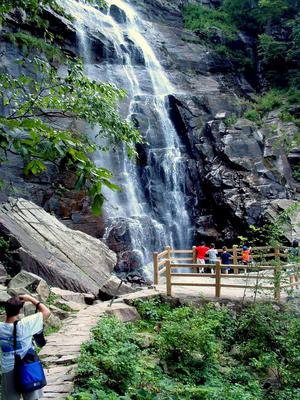
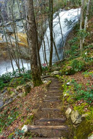
Rainbow Falls Hike
- Rainbow Falls is one of the biggest and most scenic falls in the region. An excellent 3-mile round trip hike takes you there, accessible from the newly expanded Gorges State Park access area. Several more smaller falls and some more scenery are...
- 3.0 - 4.0mi, Hilly
- Tread Condition: Moderately Rough
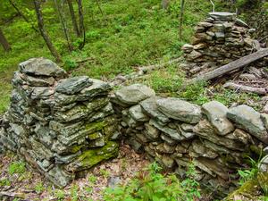
Rattlesnake Lodge Hike
- This pleasant hike takes you to the ruins of a historic private lodge along a section of the Mountains to Sea Trail. It's close to the City of Asheville, making it a nice option if you're in the area and don't have a lot of drive time. A...
- 2.8mi, Climbs Moderately
- Tread Condition: Some Obstacles
Ridgewalk Hike
- Following the mostly level upper portion of the Bennet Gap trail, this is an easy hike along a ridge to some great views. It's one of the easiest true hikes into the kind of neat environment typical of a rugged Appalachian ridgetop that we could...
- 1.4mi, Few Hills
- Tread Condition: Some Obstacles
Sam Knob Hike
- At the top of an imposing mountain peak located at the edge of the Shining Rock Wilderness, spectacular views await! A surprisingly nice, easy trail wraps around this mountain to its grassy, partly bald summit. Hike in the late summer and enjoy a...
- 2.2mi, Climbs Moderately
- Tread Condition: Moderately Rough
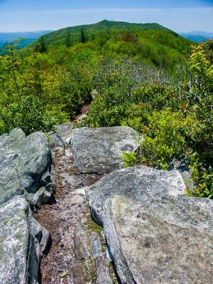
Shortoff Mountain Hike
- Climbing one of the most prominent peaks on the rim of the Linville Gorge, this hike takes you to the plateau-summit of Shortoff Mountain. A fire scalded environment lines the trail as it ascends the rocky slopes, with an open forest of young trees...
- 5.1mi, Climbs Moderately
- Tread Condition: Moderately Rough
Skinny Dip Falls Hike
- This moderate, short hike takes you to an appealing waterfall and swimming hole on the Yellowstone Prong of the Big East Fork of the Pigeon River. It makes a great summer swimming destination, a great way to stretch your legs if you're traveling the...
- 0.8mi, Climbs Moderately
- Tread Condition: Moderately Rough
Skyline-Cliff Trail Hike
- **Note:** This hike is currently closed, and according to the recently released Master Plan for Chimney Rock Park, it will not reopen. [Get more information here](http://www.ncparks.gov/Visit/parks/chro/trails.php)
This more difficult hike starts at...
- 1.5mi, Climbs Moderately
- Tread Condition: Some Obstacles
Snowball Hike
- Not to be confused with Hawksbill Mountain in the Linville Gorge, Hawkbill Rock is an outcrop along the ridge between Snowball and Little Snowball Mountains in the Great Craggy Mountains range which makes a great destination for a day hike. The...
- 2.75mi, Hilly
- Tread Condition: Moderately Rough
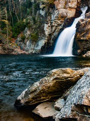
Stone Mountain Loop Hike
- Passing three of the most sought-out points in the park - the summit of Stone Mountain, the Hutchinson Homestead, and Stone Mountain Falls - this hike is as varied as the park itself. A moderate climb through open, pleasant woods gives way to more...
- 4.5mi, Hilly
- Tread Condition: Moderately Rough
Summit and Rhododendron Trail Loop Hike
- This mountaintop self-guiding nature trail, which is also a Kids In Parks TRACK trail, is a gem in North Carolina's northwest corner. You'll see virgin Northern Red Oak forests at an elevation near 5000 ft., as you stroll through an understory of...
- 1.5mi, Few Hills
- Tread Condition: Some Obstacles
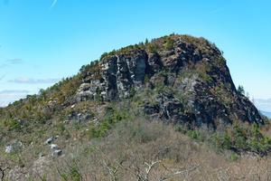
Table Rock Hike
- This trail climbs steeply to the top of a knife ridge, which from afar looks flat, giving the mountain its name. Though the rugged peak won't seem much like the surface of a table when you're standing on it, the views are unparalleled and worth the...
- 2.0mi, Climbs Moderately
- Tread Condition: Moderately Rough
Toms Creek Falls Hike
- This easy hike is excellent for families and children, with a reward at the end that everyone will look forward to. It's short enough that adults who have to carry tired kids won't be too worn out at the end to enjoy it themselves. The waterfall...
- 0.8mi, Climbs Gently
- Tread Condition: Graveled
Tuckasegee High Falls Hike
- There's a lot of neat things to see packed into this relatively short, 0.7 mi path. Even if the trail *didn't* start at a beautiful swim-worthy mountain lake and recreation area (it does), and even if it didn't pass a beautiful 60 ft waterfall along...
- 1.4mi, Climbs Steeply
- Tread Condition: Some Obstacles
Twin Falls Hike
- A pleasant hike to a pair of waterfalls in the Avery Creek section of the Pisgah Ranger District.
- mi,
- Tread Condition:
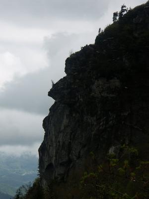
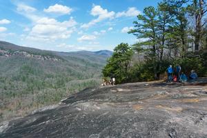
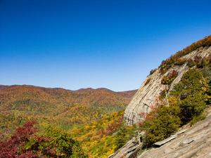
Whiteside Mountain Hike
- This excellent loop, designated a National Recreation Trail, climbs to the top of Whiteside Mountain, with its spectacular 700 ft high cliff walls lofting the hiker for amazing views. Take a camera, as the cliff-top views are lined with beautiful...
- 2.5mi, Hilly
- Tread Condition: Moderately Rough

